It was four weeks ago that we had planned to hike the Kinsmans for the first time, but in the end our old friend Franconia Ridge intervened and stole us for the day. I had hoped that we'd still have a chance to get back to the Kinsmans this fall and perhaps even get some foliage views. We had no idea the gift that we were to be given this weekend.
The name of these mountains have always made them sound inviting, friendly. Kinsmen are members of the family after all. Of course their name actually comes from Nathan Kinsman and together they are Kinsmans, not kinsmen - but I digress. However you take their names they are the source of a wonderful hike.
The last month we've had something of an affair with Franconia ridge - first hiking it on 9/10 and then gazing at it during the day that we hiked the Twins two weeks ago. This time we were on the other side and were about to be introduced to the most spectacular views yet of our old friend (with the best being saved for last).
It was another early start for a long day hike with a departure from home at 4am. The drive flew by on a beautiful autumn morning though and as we were entering Franconia Notch we got our first views of our subjects for the day.
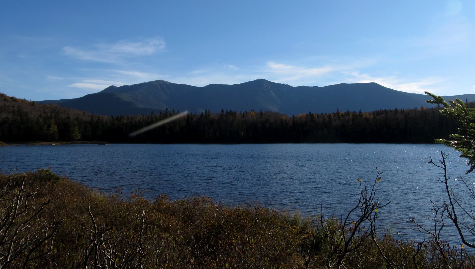
We were at Lafayette Place by 7:45 and on the trail at 8:00. The air was already warm and there wasn't a cloud in the sky. The walk through the bogs around the back of Lonesome Lake was beautiful (like always) and the morning view of Franconia Ridge over the lake gave the first image of what we'd be seeing throughout the day. The thermometer outside the hut read 60F at 9am - definitely not your typical mid-October day. While the temperatures were way higher than normal there was a beautiful cool breeze all day. You couldn't ask for a better day to be in the mountains.
Lovely birch glade
Autumn skies
Kinsmans over Lonesome Lake
Beautiful walk through the bog
Early morning Franconia Ridge
Fall colors and a Cannonball
We headed up the Fishin' Jimmy trail to Kinsman Pond. This trail is noted as "struggling over the side of the Cannonballs with numerous ups and downs". Definitely true! Most of those ups and downs are also on fairly steep rocks and ledge making for some fun going. It would definitely be a lot less fun with snow and ice. There are some interesting steps pinned to the ledges in a few spots as well. First place I've ever seen them done this way. They work well though.
Typical section of Fishin' Jimmy
Lots of up and down over the ledges
Interesting staircase
Nat heading up the stairs
North Kinsman summit ahead
We reached the Kinsman Pond junction but didn't head out to the pond - we saved that for the return trip. We headed up Kinsman Ridge and enjoyed the climb up to North Kinsman. We got a few peeks of the summit ahead as well as more of those views over to Franconia Ridge that were constantly with us. Before long we were at the view ledges just before the North Kinsman summit (or at least what we think is the summit). There were a number of people hanging out on the ledges and we didn't stay too long. We were hoping that they'd be less crowded on the return trip.
Franconia Ridge over Lonesome Lake from upper ledges. Lower ledges in foreground to the left.
North Kinsman for #29. (OK, this isn't really the summit)
Part way up the Kinsman Ridge trail we had been passed by a man carrying what appeared to be a fairly heavy pack and working hard to haul it up the steeper parts of the ledges. We followed him up to the top and exchanged comments along the way. It turned out that he's a SoBo through hiker who had started at Katahdin two months ago. We spent some time talking to him while we hung out at the ledges and he had a typical great AT story. He's from Florida and hadn't really done any hiking before starting the AT. He also thought that trails were just paths in the woods. In other words, he had no idea what he was getting himself into. He said that the first day on Katahdin almost killed him, but he kept going. He got his trail name of Slimfast because he lost 35 pounds in the first 2-1/2 weeks on the trail. He had also started out with a 70+ pound pack (that is still around 50). During hurricane Irene he stayed on the trail and rode it out in the shelters in Maine. He hasn't been doing long days but is still plugging along and most importantly loving being out there. The day we met him he was planning to go from Lonesome Lake (the only hut he stayed in) to Eliza Brook shelter - less than a 5 mile day. He was perfectly content with that and was thoroughly enjoying the beautiful weather. He said he was just going to keep going until the weather got too cold (probably just a few more weeks) and then head home and come back out later to tackle the rest. What a great attitude!!
We said goodbye to Slimfast and told him we'd see him somewhere on our way back from South Kinsman. We headed up the trail and when we had gone a few hundred yards I realized that we were going down into the col and had forgotten to look for the true summit. No matter, we'd be coming back this way could find it then. It was a nice walk through the col - one of those spots between close peaks where you feel like you just is a beautiful spot in the woods rather than on top of a mountain. We made the short climb out of the col to South Kinsman and were soon on the broad, flat summit plateau. We wandered around to the various viewpoints taking in the vistas in all directions. The foliage colors were brightest in the valleys to the west and it seemed like all we could see were mountains spreading out in every direction, even though the haze of warm day somewhat blurred the view.What a spot this must be on one of those 100 mile visibility days in the winter!
South Kinsman ahead
Following the white blazes through the col
Looking back to North Kinsman from South summit plateau
Mt Moosilauke in the haze
Glider soaring over the colorful valley to the west
South Kinsman for #30.
We spent a long time on the summit eating lunch and lazing in the warm sun. We knew we had a long way to go though so we finally pried ourselves away and headed back the way we came. We were almost back to North Kinsman when we met Slimfast again. He'd taken a long break on the NK ledges and was totally enjoying the day. We chatted for a few minutes again and wished him well with the rest of his hike. I could hear the touch of sadness in his voice when he talked of having the leave the trail soon when the cold weather comes. I hope he gets a nice stretch in between to enjoy as much more of New England as he can. When we got back to North Kinsman we hunted around for the spot that was described as the real summit. I'm not sure if we found it and honestly don't really care - it doesn't make the day any less great. When we returned to the view ledges we now had them to ourselves. What a treat! We made our way down to the lower ledges to get the view down to Kinsman Pond directly below us. It was well worth the wading through mud and bushes. What an amazing spot! I had just finished reading
Following Atticus the day before and I thought of Tom and Atticus many times during the day, but particularly here. I could imagine Atticus sitting on the edge of that ledge and staring endlessly out at those amazing vistas. This is certainly a place to go to perfect the art of summit sitting.
Heading back. Does this mean we did an AT Flip Flop?
Autumn colors under foot
Mossy shadows
Nat on the real North Kinsman summit - maybe...
Cannon and the Cannonballs over Kinsman Pond from lower ledges
Hey - get back away from that edge!!!
On top of the world
Franconia Ridge over Lonesome Lake in the afternoon sun
One last minute to enjoy this please
We finally dragged ourselves away and began the trip down. We had discussed possibly taking a bit of a longer route down rather than going back the way we came so that we could see more new trails. We seemed to have plenty of time so when we got back to the Fishin' Jimmy junction we turned toward Kinsman Pond. The tent sights were mostly empty and there were just a few packs at the shelter. It sure would have been nice to be able to spend the rest of the beautiful afternoon and night there but that would have to wait for another day. We headed along the shore of the pond and took in the beautiful views of it from all angles. I was already glad we'd decided to take this way down.
Didn't find a marker at either summit but this one is at the junction with the Mt Kinsman trail. WTH?
Heading back down Kinsman Ridge
Kinsman Pond tent site
Nat checking out the Kinsman Pond shelter. Wish we were staying
Kinsman Pond
Along the Kinsman Pond trail
Kinsman Pond from the far end
Soon after the pond, the Kinsman Pond trail becomes a magical place. The woods are alive with mosses and the green is more intense than anywhere I've ever been. Much of the trail descends right through the middle one of the several brooks that runs through this area. There wasn't another soul in sight and it was a wonderful, peaceful walk. Further down the trail leaves the brook but at that point there are brooks and cascades close by on both sides, just far enough a away to be hidden from view. The sound of water is everywhere and it just seems to envelope you.
The picture cannot convey how green this was. Magical place!
Following the brooks
Beautiful cascade and pool. Looks like a great place for a summer swim.
The sounds of water were everywhere
We had the choice of taking the Cascade Brook and Basin Cascade trails back to the bottom but that would leave us with two miles on either the Pemi trail or the bike path back to the car so we decided instead to take the Cascade Brook trail back to the hut and then descend from there. The Kinsman Pond trail is supposed to end and connect with the Cascade Brook right after it crosses the brook. I had been watching the GPS to get an idea how close we were and when I checked again it showed that we were off the trail and past where the junction was supposed to be (and also on the wrong side of the brook). We went a bit further since we hadn't seen anyplace to cross the brook and the blue blazes continued on this side. As we were standing by the brook looking for a place to cross we saw people walking through the woods just beyond the brook on the other side. The blazes continued on our side but we found a place to rock hop across and easily found the Cascade Brook trail on the other side. I still don't know where the official crossing point was or if the trail was relocated but was glad to have the GPS to give us the clue that something was off.
I had guessed that it was about 1/2 mile to the hut on Cascade Brook based on looking at the map on the GPS. It's actually more like .9 and it's back uphill. It isn't steep or difficult in any way and is in fact a pretty section following along the brook, but we were both tired at this point and not mentally prepared to be going uphill again. We grumbled a bit and I started to question my decision to go this way instead of just going back down Fishin' Jimmy. I was determined not to let my head spoil a nice day though. We got back to the hut at around 5pm and I suggested that we walk around the north side of the pond again even though its a few tenths longer. I knew how much we both loved that section of trail and figured it would be a nice way to reset our mental state and end the day. I didn't realize just how good a decision that would be until we were half way around and presented with this view. Franconia Ridge was bathed in the warm late afternoon "golden hour" light, the trees along the other shore of the pond were lit up with their autumn colors and the whole thing was reflected in the calm mirror of Lonesome Lake.

The rest of the walk through the bog along the lake was equally beautiful. Had we taken the shorter route down we would have been too early to catch this amazing light. For many reasons it had been the right decision. With our spirits completely recharged we just about floated back down the trail to the car. The Kinsmans had proved to be as wonderful a place as anywhere we've been in these mountains and we're looking forward to more visits with our kinsmen in the future.
Walking through the marsh
Golden end to the day
There are many more photos here:
https://picasaweb.google.com/114856685929776719960/Kinsmans10911#
Here's our route and a few views from above courtesy of Google Earth