Here we go with another long trip report. Tried to keep this one shorter than our STP week report but it is hard to cram in a short description of a packed 6 days...
We had another fantastic week in Acadia this year. Stayed at the Mount Desert Campground which is at the head of Somes Sound (the fiord that runs up the center of MDI) right on the water. There are about 30 waterfront sites with tent platforms – some actually handing out over the water on the rocks. If you are looking for a place to camp on MDI it doesn’t get any better than this. Very short drive to most of the trailheads for hiking and the carriage roads for biking and you can drop the kayaks in from your campsite to paddle the harbor and the sound or keep it tied up to the 350’ long float/dock that gives access at all tides. Awesome place!! More info and pics here: http://www.mountdesertcampground.com/pics.html.
We were once again blessed with amazing weather. It rained a little the day after we arrived and after that we had 5 straight days of clear blue skies and 70 degree temps with nice cool nights. We got in at least one hike each day along with either a bike ride on the carriage roads, a paddle or both!
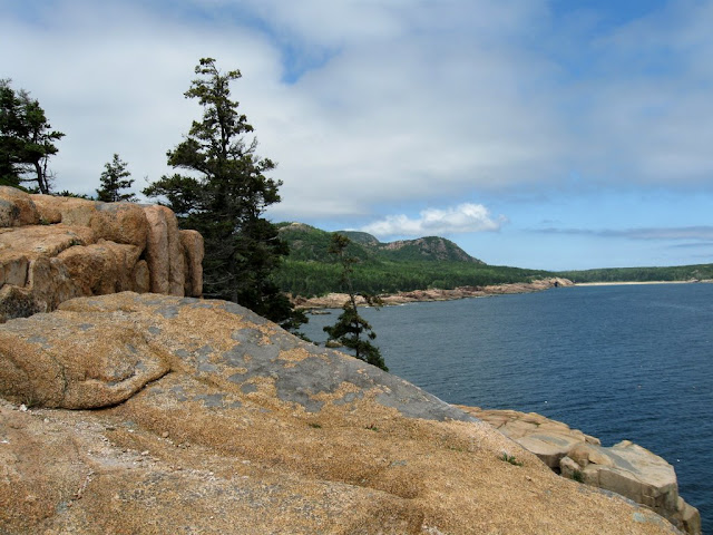
We planned to get some new hikes in this year and hit a few of the mountains that we hadn’t gotten to in the last couple of trips but we wound up doing many of our past favorites again (and weren’t sorry that we did – I could hike these trails many, many more times and not get tired of them). The best part about hiking in Acadia is that you have nearly continuous views almost everywhere you go. You can start at the base of a mountain, hike for 15 minutes in the trees and emerge onto the first ledges which just continue to the top. It’s like hiking above treeline in the Whites all the time except that the ocean and lakes are constantly in view on the horizon (or at your feet) and you are way less exposed if the weather turns (at least in that you can get down to shelter much quicker). Here’s a quick overview of each of the hikes and "other activities".
The complete photo album is here: http://picasaweb.google.com/mtruman42/AcadiaAugust08
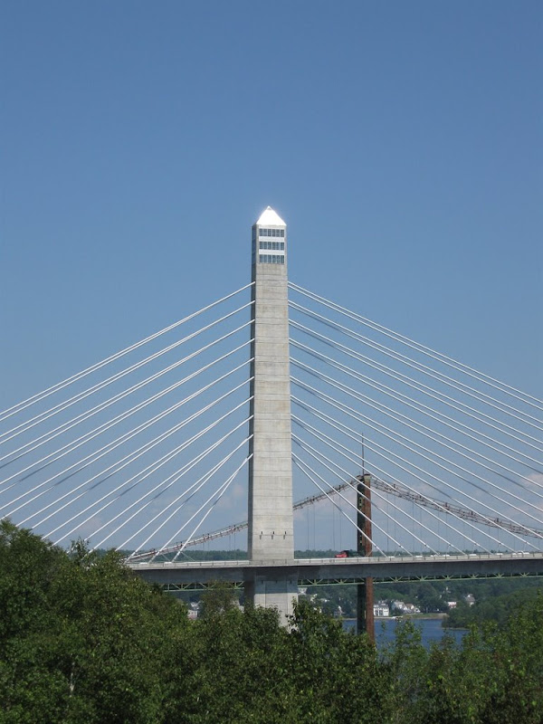
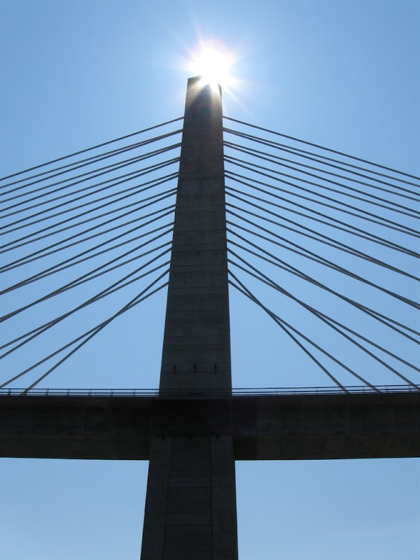
Penobscot Narrows Observatory
On the way up to Acadia we stopped at the new Penobscot Narrows Observatory (part of the new bridge to Bucksport). One of only 3 bridges like this in the world. Very cool! http://en.wikipedia.org/wiki/Penobscot_Narrows_Bridge
Observatory at top of first tower
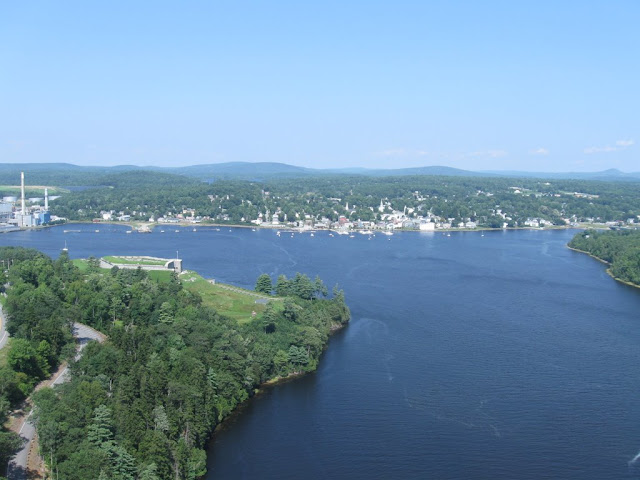
Views from the top - Bucksport and the mountains beyond
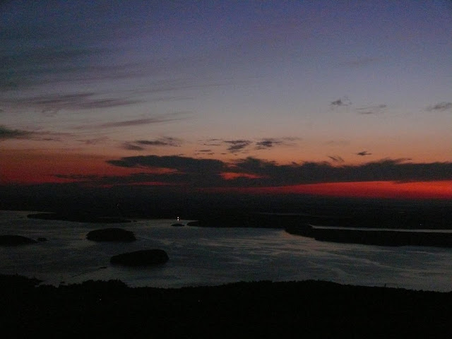
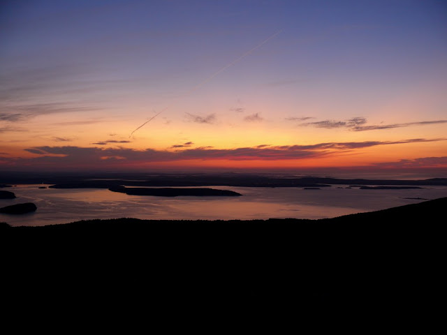
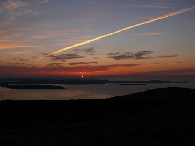
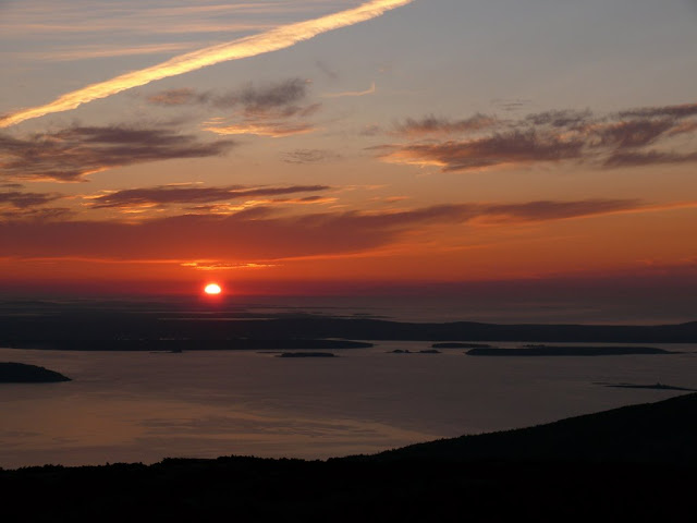
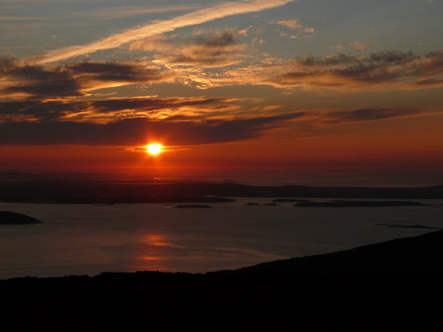
Cadillac Sunrise
Being only 20 minutes from Cadillac summit makes it hard to resist going to see the sun rise in the first place in the US. Getting there about 45-60 minutes before sunrise (about 4:30 this day) gives the best views. Sky is most beautiful before the sun comes up. Amazing colors this day when the sun went back into the low clouds right above the horizon 10 minutes after it came up. The pictures definitely do not do it justice - you have to be there.
Sky catching fire an 45 minutes before sunrise
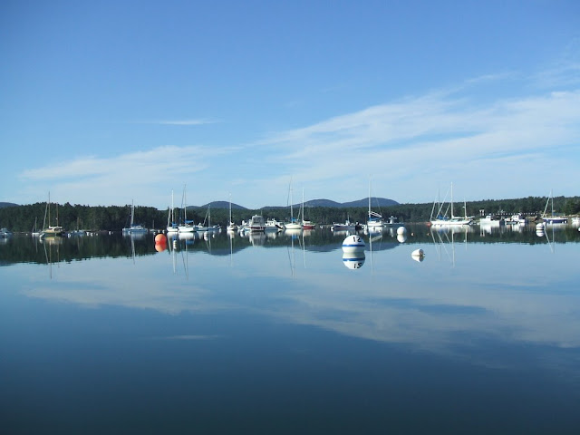
Somes Harbor
The paddling in Somes Harbor is beautiful and it literally takes 5 minutes to get the kayaks in from the campsite. The harbor is protected and very smooth most of the time while Somes Sound has a nearly constant stiff breeze that keeps the water pretty rough and the paddling more interesting than we prefer in our open cockpit boats. If you hit the 60-90 minutes on either side of high tide you can paddle under the bridge across the road to a beautiful tidal inlet (which we managed to hit the timing for this year.
Tidal inlet under the bridge at high tide
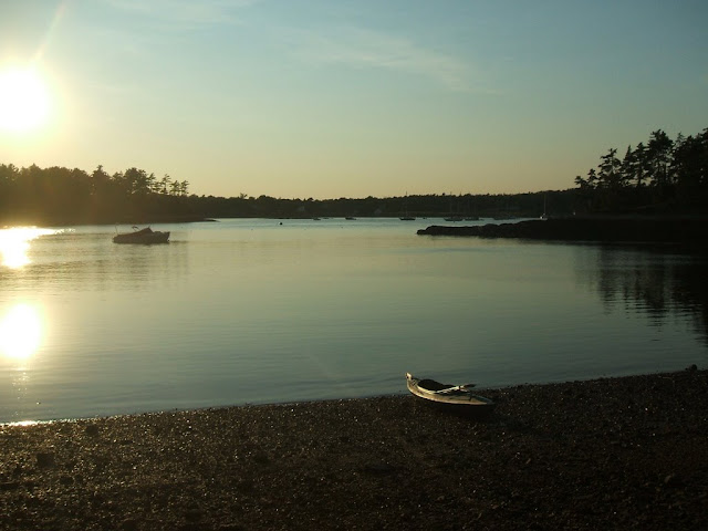
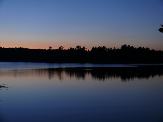
Typical sunset on the cove from the campsite
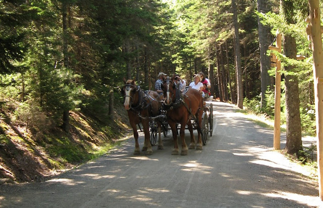
Carriage Roads
There is no place better to ride bikes than the 50 miles of carriage roads in Acadia. Perfectly maintained and reasonable grades (even going up a couple of the mountains). The views everywhere are incredible whether in the woods or along the lake and pond shores (including the path high above Jordan Pond). We did 3 trips this year. 5.5 mile loop from Eagle Lake carriage road lot around Witch Hole Pond, 6.5 mile loop from the same lot around Aunt Betty Pond and the western shore of Eagle Lake and our favorite ride - a 12 mile loop from Jordan Pond House around Day Mountain, along Bubble Pond to the south shore of Eagle Lake and then down along the western shore of Jordan Pond. Spectacular views on this whole route and great places to stop on the shores of the ponds for snacks and lunch.
Part 2 - Acadia Hikes
Champlain Mountain
The Precipice Trail goes up Champlain east face but that's not happening with my acrophobia. Starting from Sieur de Mont Spring and going up the Beechcroft trail to the summit. Took the Bear Brook trail south from the summit for about a mile to a set of ledges looking down over the Beehive and the Bowl. Beautiful spot. Back up across the summit then down the Bear Brook trail to the loop road with a short walk along the road back to the car for about 5 total miles.
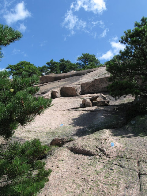
Lots of nice steep ledge walking
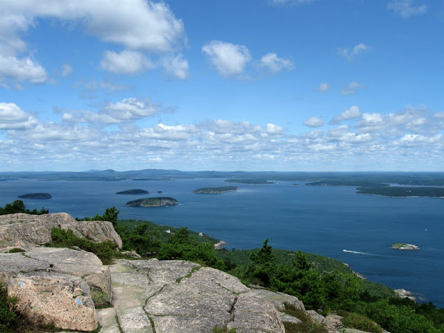
Frenchman's Bay and the Porcupines from Champlain summit
A little advertising for Seek the Peak
Penobscot Mountain
This was my favorite of all the Acadia hikes (before did the complete Bubbles loop this year). Over half the route is walking over the open ledges up and down the ridges. It is best when combined with Sargent Mountain (up Penobscot, through the col to Sargent and down the Sargent East Face trail). We skipped Sargent this time because my daughter had a sore foot from cutting it on the rocks swimming the day before. Route is from Jordan Pond House up the Spring Trail and Penobscot Trail to the summit. Down the Deer Brook trail to the north shore of Jordan Pond and then along the western shore of Jordan Pond back to the start. 4 miles and 3 hours with lots of delays to soak up the views along the way. Sargent adds another mile.
Long open ridge walk after the Spring Trail
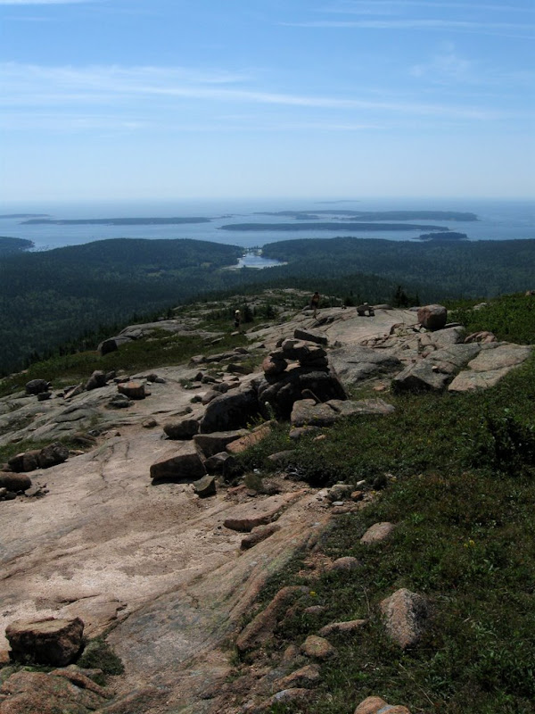
Mountains reaching to the sea
Beautiful tarn at the summit
Jamie claims the summit
Returning on Jordan Pond trail
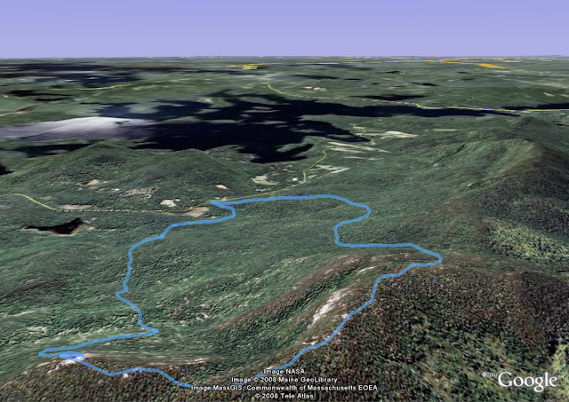
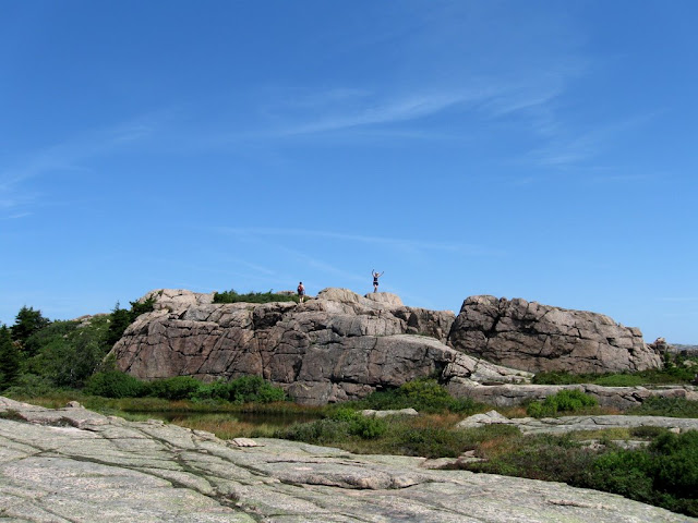
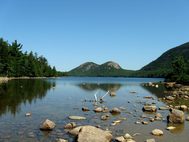
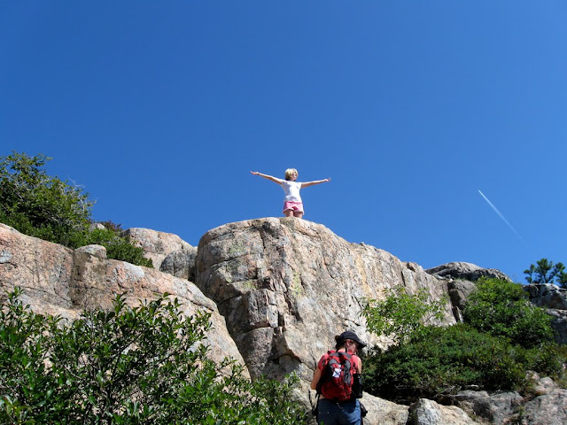
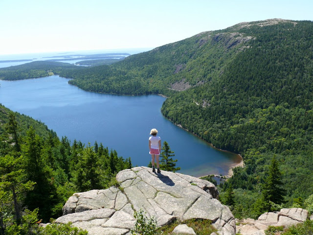
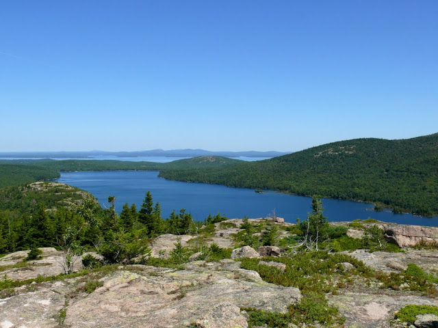
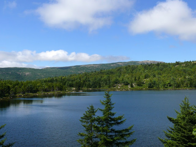
The Bubbles
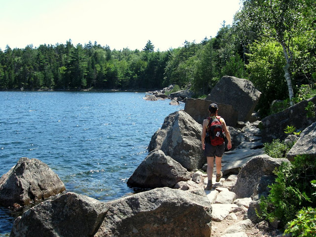
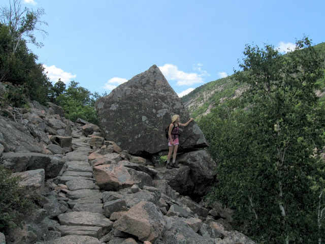
We've done the South Bubble several times in the past and this is one of the parks most popular hikes (meaning lots of traffic). This time we took the long way starting at the Bubble Rock parking area and going south on the Jordan Pond Carry Trail to the South Bubble trail then up the South Bubble (great steep climb with a bit of fun scrambling) and over to the North Bubble then down the open ridge to the carriage road below Eagle Lake (most beautiful part of the hike). From here the trail loops up and over Connor's Nubble - a beautiful open ledge overlooking Eagle Lake - and down to the shore of the lake. From here the Jordan Carry Trail follows the shore of the lake with lots of climbing over the jumble of boulders along the shore and then back through the woods to the parking area. 5 miles and 3.5 hours at a leisurely pace. This has now replaced Penobscot as my favorite Acadia hike.
Classic view of the Bubbles over Jordan Pond
Jamie claims the first tough scramble
Looking over Jordan Pond from North Bubble
First views to Eagle Lake from North Bubble
Eagle Lake with Connors Nubble in view (to left of lake)
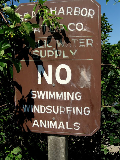
I didn't know that there were any swimming animals that knew how to windsurf...
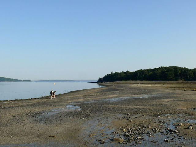
Bar Island
You can hike out across the sand bar to Bar Island right off Bar Harbor for about 90 minutes on each side of low tide. Nice trail to the high spot on the island with views back to Bar Harbor. Total hike is 2 miles and about and hour or so. Just don't stay too long and get stuck - it's a long time between low tides...
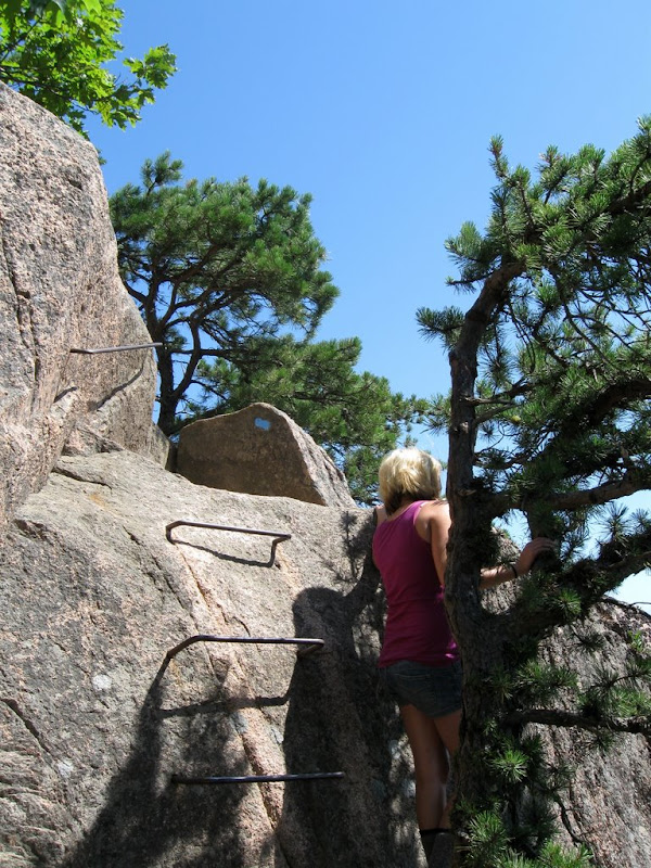
The Beehive and the Bowl
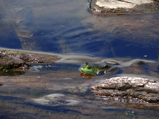
By far our favorite short hike in Acadia. Pushes my acrophobia to the limit with the narrow ledges and iron rungs/ladders to aid the scrambles up the face. This was my 4th time and it's starting to get a bit easier. Views from the top and on the way up are incredible. We always take the trail over the back of the Beehive down to the Bowl (beautiful mountain lake), along the shore and then back down the Bowl trail. Best to do this one early in the day while it is still possible to get parking at Sand Beach. Total hike is 2 miles and takes about 2.5 hours when you linger on the summit ledges and stop at the Bowl to harass the frogs ")
The route up the Beehive - straight up
Assistance from iron rungs and hand rails make the scrambling more reasonable
Jamie at her favorite leaning spot taking in the view to Sand Beach
Champlain, Dorr and Cadillac from Beehive summit
The Bowl is reached after crossing the Beehive
One of the local residents of the Bowl
Lunch on Otter Cliffs with a view back to Sand Beach and the Beehive