
Since we first heard Kim talking about camping out on the top of Stairs Mountain I was fascinated. It sounded like such an amazing spot. When I read Dan's account of he, Janelle and Meena camping on Stairs (in the new book The Adventures of Buffalo and Tough Cookie, which you must read) I really knew that we needed to do it. There are a bunch of ways to do this hike including various combinations of Crawford, Stairs, Resolution and Parker. The loop of all four with a car spot would make a perfect two day backpack (or even a longish day hike) as Buffalo and Tough Cookie proved. Did I mention you need to read the book? You can also visit their website - http://52withaview.com - for more info on the book and their blog on their ongoing journey. The 52 With A View has become our next list of choice (along with finishing the NE67), in no small part due to Dan and Janelle's inspiration. But for now, on to this hike...
When our daughter Jamie came home from college this spring she casually mentioned to us that she'd like to backpack with us this summer. Since she hadn't hiked with us in almost 4 years (the last times being Seek the Peak and our backpack to Bondcliff in 2009) we knew we couldn't pass this up! A night on Stairs seemed like the perfect plan. Kim and Jen were joining us, so we had the car spot option, but in the end we decided between the timing and weather forecast that Crawford and Stairs would be just fine.
We planned an extravagantly late 11am start giving us all time for the 3-4 hour commute from RI and VT without having to leave before the sun was up. We once again got snafu'd by unexpected traffic jams in RI (who would have figured that they'd have 3 exits worth of Rt 95 closed in Pawtucket on a Saturday morning), but the rest of the trip was smooth sailing and we met Jen just a few minutes late. The forecast was for showers and thunderstorms, but not till later in the day. We hoped to be to the summit and have camp set up in plenty of time.

Low water in the Saco River

Parade on the bridge

Our first journey on the Davis Path
The first few tenths of Davis path are pretty flat. Then the grade starts and steepens and basically doesn't let up until you get to Crawford. Rocks, roots and MANY stone steps are the standard.

Our first journey on the Davis Path

First views of Crawford Notch from the ledges on Crawford
When we got to the first set of ledges we stopped for a break. The black flies were getting thick (but nothing compared to Maine last week). We all were prepared with our oh-so-stylish head nets.
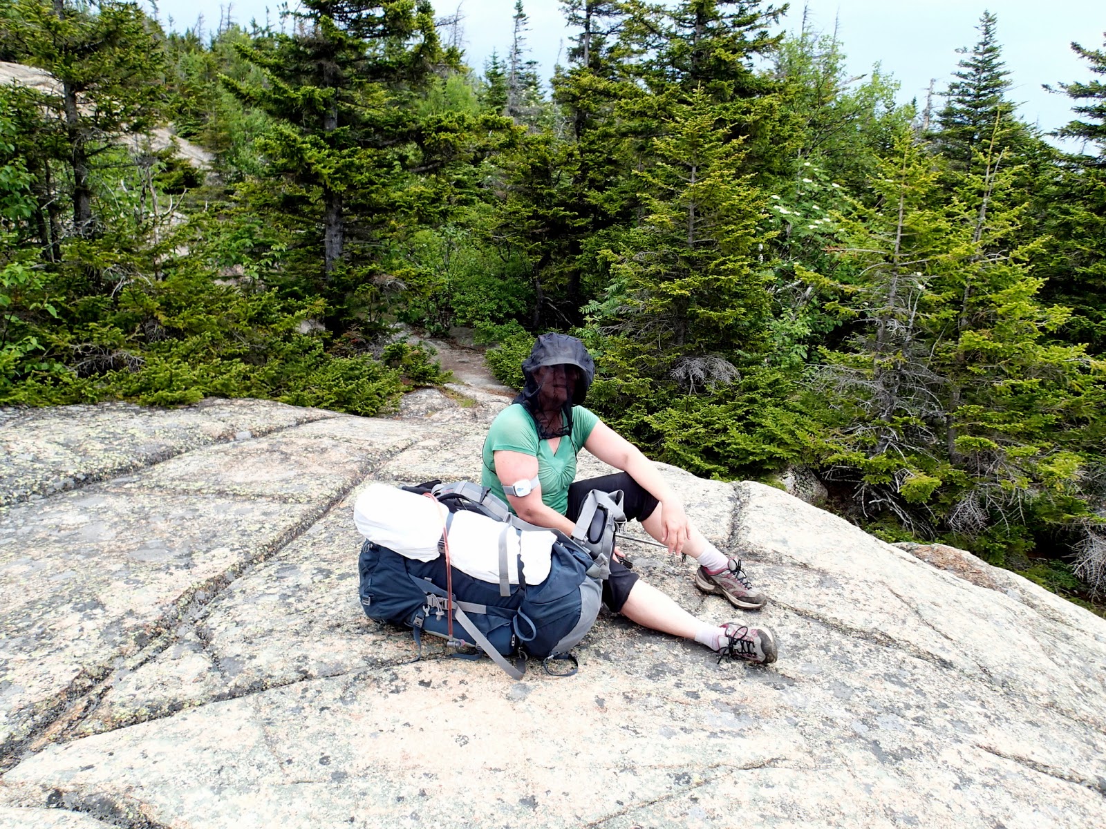
Jen tries her bug defense

Nat and Kim head up the ledges

Kim sporting some stylish headwear
The rest of the way to the top of Crawford is basically all ledge walking from here - pretty steep from the Crawford spur to the top. We ditched our packs in the woods at the junction to make the going easier. We got our first look at our final destination from the ledges along the spur.

Almost to the spur

Beautiful panoramas even in the clouds

First look at our final destination - Giant Stairs

Zoom to Stairs. Arrow shows our home for the night
The views from the top of Crawford were BEAUTIFUL! The clouds and haze couldn't do anything to spoil them (but I can't wait to visit here again on a clear fall or winter day).

Jen on Crawford

Taking in the views

Labrador Tea


Jamie daydreaming

Elderberry?
We headed down from Crawford and up the Davis Path toward Resolution and Stairs. The section between Crawford and Stairs Col is very flat and and very nice walking. We debated where we wanted to try for a water fill-up for the night since there is nothing near the top of Stairs. There was debate over whether there was a stream crossing the path near Stairs Col, or whether we should use the water source near the old Resolution Shelter (which has now been torn down). Nobody really wanted to go down to the shelter site as it was described as "like going down to Guyot". Jen and I got to the junction first and I decided to go down the spur toward the shelter site to check it out. I went what seemed like a long way down and saw some timbers and lumber that looked like they could have been part of the shelter. There was no sign of a water source so I kept going and then lost the trail. Figuring it must have grown in I headed back up (a pretty steep little climb). By this time Kim, Nat and Jamie had arrived. Kim was pretty sure that there was no water further up the trail and decided to go down to see if I'd missed something. She reappeared after a while saying that she'd found the water source. We gathered all of our containers and filters and headed back down. It turned out that the spot where I'd seen the timbers and shelter remains was in fact the old shelter site and the water source was about 20 yards down from the side of it (not the direction I went). We filled all our containers with the icy water and Kim and I got to take our second trip back up the hill. Live and learn...

Heading down - fully netted

Jen was prepared for the rain showers too

Site of the old Resolution Shelter. Not much left (water source is down to the right)

Typical Davis Path between Crawford and Stairs Col
I had been warned that the climb up to Stairs from the col was very steep. The section to the Stairs spur junction is in fact quite steep and there are a few ledge scrambles, but it was easier than any of us expected. From the spur out to the tent sites and the summit ledges is a nice flat walk in the woods to an amazing reward!

Tent site sign at the Stairs junction

Yup, this is it

First views from Giant Stairs summit ledge. What a place to spend the night!
We would love to have just sat the and enjoyed the views for the rest of the evening, but we really wanted to beat the rain and get our tents set up. We'd had a quick passing shower while we stopped for our water refill, but it was still dry up here so we'd caught a break. The tentsites are amazing - two right at the end of the trail almost on the ledges and one a bit further back (just 50' or so). There was even room for Kim to set up her tiny one-person tent with the door almost on the ledge. What a view to wake up to!

Kim taking it all in

Fly over

Clouds boiling up from the col

Stairs benchmark

Kim's campsite has quite the view!

Ours is a little further back...

...but still not a bad spot to be!

Jen tucking into the end site
It didn't take us long to get settled and we headed out to the ledges for a libation and to enjoy the views. Everyone had collected firewood (lots to be had up here) and Jamie made a fire. A light rain started falling soon and we got dinner ready and ate before it got any harder. It was nice sitting out there even in the damp, enjoying the fire and watching the clouds flow up from the valleys.

Jamie capturing the view...

and enjoying being up here!

Jen came fully prepared!

Hanging out before the rain

Jamie made one excellent fire!

Kim cooking dinner

Nat in the clouds

Ah, guess she was hiding this :)

Keeping the fire going in the rain takes some work

Long way down!

Clouds surrounding Mt Resolution

The fire is just about perfect...

...it must be time for...

...s'mores! Thanks for bringing the fixin's Kim!
We were all starting to get soggy and cold. The forecast said that the rain should pass by around 9pm and we were hoping that meant some clear skies for star gazing or a close up of the much hyped "super moon", so we decided to take shelter in our tents for a while and come back out later. It was only 7:30 and definitely too early to turn in for the night. I took a "nap" and woke back up around 9:30 to hear the rain still falling on the tent. I got out to check the skies and there was still no sign of clearing. Looked like no moon or stars for us tonight. During the middle of the night the rain stopped. I briefly thought about going back out to check the sky, but it was just too comfortable in the sleeping bag. Around 5am the rain started again, so no sunrise from the summit either. By around 7 it had stopped again and we all emerged to have breakfast and get packed up. There was a beautiful undercast in the valleys and the lack of sunrise definitely didn't do anything to spoil the morning views. There is nothing in the world better then waking up above the clouds.

Morning undercast

Fog in the valleys

Kim getting breakfast ready.

Fog and clouds rolling up

A little brightening to the south

In the clouds

What better place to have your morning coffee? (or cafe mocha as the case may be)

Is that a tent fly or a sail?

That's one light & small tent (or the perfect emergency signaling device) :)

How'd he get up here?

Islands in the mist

The cloud salute pose?

Morning stretches

Contemplation
The forecast for the morning looked better and we had a chance for even seeing some blue sky and sun before the afternoon thunderstorms moved in. We got on the trail by around 9 and started to head down. Jen left a few minutes early and then I followed with Nat, Jamie and Kim just a few minutes behind me. We'd all catch up with each other shortly or meet up at Resolution col. Uh, yeah - right.
When I got to the intersection of the Davis Path and the Stairs Spur I made a bit of an error in judgement. I glanced down the path that makes a sharp left here (the correct way to go) and mentally noted that this was the other side trail that goes to the bottom ledges on Stairs that we went by yesterday. I didn't notice either of the trail signs (tent site andStairs Mt) at the junction and blindly walked straight ahead - north on the Davis Path. I went probably 1/2 mile or so before it began to occur to me that this wasn't right. Mistakes like this make you realize how simple it is for people to get lost in the mountains. In my case I had a GPS (hanging about 6 inches from my face) that let me quickly confirm I was going the wrong way. Just plain dumb! At least there had been some nice wildflowers to see on the detour...

The path home (or so it seemed)

Goldthread after the rain


Clintonia
I turned around and started back in the right direction moving as quickly as I could. I didn't want the rest of the group to start looking for me when they realized that I wasn't where I was supposed to be. I got to spur junction again and started yelling ahead, but no response. About half way down to Stairs col I started hearing voices yelling back from below. Sounds carries in strange ways in the mountains and it was hard to hear what we were yelling at each other. They were actually all the way down at the Resolution shelter spur (where they'd met Jen). They of course asked her where I was and she of course replied that she hadn't seen me - which everyone figured was impossible. There were now two trail junctions in between so it wasn't obvious to them where I'd taken the wrong turn. Worse, when they heard me calling them from well above them on the way down Stairs, they thought my voice was coming from below and that I'd somehow followed a drainage down into the woods and was now off trail. Jamie actually yelled to me to ask me if I was off trail and either I heard something different or she heard a different response, since she thought I said that I was. All of the only took 15 minutes or so to sort out and was not a big deal in the end. It's definitely proof that waiting for groups to reconnect at each junction is always a good idea though. Live and learn...
The walk the rest of the way out was nice - more wildflowers, ledge views and clearing skies.

Heading out

Sheep Laurel buds

A few opening

Ledge sidewalk

Mt Crawford (and some blue sky)

Mountain White Cinquefoil

Down the last of the ledges from Crawford

Can almost see the car from here...

Wild Blackberry

Looks like a nice place for a dip!
Sunday was a warm, humid day and we were all hot, sweaty and dirty when we got out. The cold water of the Saco River was just too tempting to pass up. We dumped our gear and waded out into the river to swim and get cleaned up and cooled off. It was the perfect way to end the day. On the way home we stopped in Ashland and met Christine for lunch and schemed about our next trip in a couple of weeks. But that's a story for another day...
The interactive GPX track is here: http://www.gpsies.com/map.do?fileId=jwjhtjqqxeqnyxqq
Here's the route map (and where not to go when heading down from Stairs...

Full route

Red circle marks the Stairs spur junction. Yellow highlight is my errant route.
