Pages

Monday, July 25, 2011

The Final President - Mt Jefferson

It had already been an incredible Seek the Peak weekend but we weren't quite ready to go home without one more hike.  My sore knee from the hike Saturday had worked itself out and by Sunday night it felt 100% ready to go.  The weather forecast was calling for afternoon showers and thunderstorms but we figured an early start would deal with that.  One more day, one more president...

Four years ago when we first hiked across the Presidentials we made some interesting choices.  On the day we hiked from Madison Hut to Lakes of the Clouds we chose to bypass all of the summits (which we'd never been to before) and just enjoy the amazing day above treeline.  I've never had any regrets about that decision.  Once I'd realized that we wanted to eventually finish all 48 I was perfectly happy with the idea that we'd be able to go back and visit those that we'd skipped the first time.  Since then we've been on Mt Washington 4 times and Saturday we had our first trip to Adams in one of the best hikes ever.  The only one left on the list was Jefferson.  Tomorrow was the day.

We had decided to get an early start on Monday to be sure to beat the storm so we turned in early and planned to head out from Moose Brook at 6:00.  We'd come back after the hike and pack up the tent and gear to head for home.  I slept fitfully (as I always do with the anticipation of a great day ahead) and at 4:30 I was wide awake and listening to the birds singing before the sun came up. It had dropped into the 40s overnight and the temptation to burrow back into the sleeping bag was strong - but not today.  I got up and dressed and started packing up my stuff while Nat continued her peaceful sleep.  I checked the morning higher summits forecast and it sounded even better, with the storms not forecast till later in the afternoon.  After Nat got up I decided that it was foolish to have to come back to the campground (40 minutes in the wrong direction) after the hike, and before she got back from washing her face I had the tent down.  We packed up everything in record time and were on the road by 6:30.  Stops for coffee and breakfast and the drive down Jefferson Notch Rd had us on the trail in an hour.  The sky was brilliant blue with puffy clouds drifting by and the air was cool and fresh - a wonderful relief after the steamy weekend.  Definitely a Presidential day!

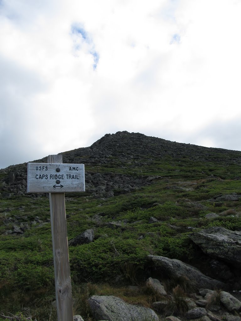
We set off on the Caps Ridge trail and enjoyed the walk through the cool woods with sunlight filtering through the trees.  We soon reached Pothole Rocks and looked for signs of the Gray Jays that were rumored to hang out there.  The welcoming committee never appeared, but what we were greeted by was the spectacular view of the southern Presi's.

Pothole Rocks

Southern Presi's and beyond

Views to the West

Jefferson Summit ahead

Nat is enjoying the day already!

In another half hour we were at the first Cap.  If you've read my prior hiking accounts you know that I a) suffer from acrophobia and b) love rock scrambling.  These two may seem a bit contradictory but basically as long as I have something to hold onto and don't feel like I'm balanced on the edge of the world without a railing I'm just fine.  Having heard numerous accounts of the Caps I felt pretty sure that they'd fall within my comfort zone.  Nat on the other hand has absolutely no fear of heights (or anything else in the outdoors as far as I can tell) and loves the scrambling even more than I do.

Cap 1 ahead

Nat enjoys being on the rocks

Lot of this

Cap 1 went pretty easily with the exception of one fairly long section of steep ledge.  The handholds on this one were minimal and it was fine going up the dry rock, but I was already starting to think about how it was going to be coming down.  But that's a problem for later.  Having talked to our friend Val the previous day (who feels about the same about these spots as I do) I was told that there was nothing too difficult or scary here - just a bunch of places where you stand for a minute and figure out where the heck to choose to go up.  She was right - so far.

On Cap 2 things were a bit more interesting.  There was an even longer and steeper section of smooth ledge and again I got up it with no problem but now I was getting a bit freaked out by the return trip.  I really wasn't sure how I was going to go down this one. God forbid it should start to rain before we got back here.  As those of you who know me can attest, I worry - a lot - usually about nothing. I should also note that while I was being troubled by this seemingly tricky little ledge Nat was at the top of the Cap.  It's like following a mountain goat.

Path is through the cleft to the right of the cairn

Steep face of Cap 2 ahead.  The tricky spot?

The mountain goat ruling her domain

Looking back over the first 2 Caps

The tricky parts were over and Cap 3 was just a fun scramble.  By the time we were at the top I'd almost stopped thinking about how I was going to get back down.  I knew from reading other trip reports (and a couple of accident reports in Appalachia) that there really isn't a better alternative using the Castle Trail and the Link and any other way off is totally in the wrong direction.  Onward and upward...

Cap 3 and summit ahead

Nat coming up Cap 3

Trail skirts the edge here.  Great view down ;)  Summit ahead!

Three Caps down

Mt Washington comes into view

Final trail to the summit

At the junction with the Cornice Trail we decided to continue up Caps Ridge and then over the summit and back around the side.  We had been warned about the sharp rocks and need for use of hands on the way up this route, but we decided to go this way anyway.  The warning was of course correct (hey, this is in the northern Presi's after all) and having gloves would have been a bonus, but it wasn't too bad and we were quickly on the summit and enjoying the incredible views.

No more Caps - just lots of this

Typical northern Presi rockpile

Mt Washington over Mt Clay

Looking to our Saturday summit - Mt Adams - from Jefferson summit

Perfect day and an awesome hike for the final president and #26.  (We'll be back!)

We took a break on the summit to soak in the views and get a few pictures (once again the tiny tripod earns its keep).  There was a group headed across from the north and we left the summit to let them have it to themselves. We stopped to say hello and they told us they were headed from Madison Hut to Crawford Notch (an almost Presidential Traverse) and we wished them luck with the weather as we headed off.  We went down the Jefferson Loop to the Gulfside Trail and over to the Cornice trail to skirt the summit back to Caps Ridge.  The walk around the summit cone was beautiful and break from using hands on sharp rocks was welcome.  We were soon back at the junction and ready to head down.

Jefferson Loop and Gulfside Trails

Gulfside Trail and Mt Adams

Mt Clay

Nat on the Cornice Trail

The Jefferson rockpile

Caps Ridge junction ahead

We took a snack break at the junction and then headed for the descent over the Caps.  I hadn't thought about this a single time since we hit Cap 3 on the way up but now I was starting to fret over the climb down again.  We headed over Cap 3 which I knew was easy and came to Cap 2.  Nat was ahead of me and zipped down all the seemingly tricky spots.  When we reached the tough spot on Cap 2 I simply sat down, stuck my feet out and butt slid between footholds.  It turned out to be easier than it was going up.  Once again worry for nothing.  The "tricky section" on Cap 1 was even easier, and I in fact kept waiting for it and had to look back when we were done to figure out where it was.  Turns out that this was just a blast in both directions and I can't wait for a chance to do it again!

Heading back into the darkening skies.  Good timing

Downward cap-walk

Interesting spot for a cairn

Happy mountain goat

Hiker behind us (center) descending Cap 2 the hard way.  The blazes may go here but the route to the left is *much* easier.   

Close up of pic from above.  I couldn't watch her on this section but she somehow made it without slipping off.

On top of the world on a fantastic day!

The rest of the hike down was quick and uneventful.  We met a number of other hikers that were on their way up, and I was glad that we'd had the early start and avoided the storms, and hoped that they all would make it up and down safe and sound.  As we reached Rt 302 and turned into Fayban's Station for lunch the rain started.  We had a nice lunch (our first time to try Fayban's and we'll definitely be back) and then headed out for the drive back to Rhode Island.  On the way home we drove through continual downpours on a weather radar map covered with reds and yellows.  The drive went fine and mostly my thoughts were with those that we'd seen headed up the mountain.  Hope their days all ended OK.

And so we'd visited our last president on the list.  Saturday and today confirmed my feeling that we'd made the right choice four years ago.  I know that we enjoyed them more this weekend than we would have then.  I'm also not sad that they are now "off the list" because there is no list in the world that could keep us from visiting them many times again.  If those times are even half as good as these were they will still be amazing!

For a bunch more pictures, Google Earth views of the route and route map visit the album here:  https://picasaweb.google.com/mtruman42/MtJefferson72511#

Saturday, July 23, 2011

Seeking an Alternate Peak - Mt Adams via King Ravine

Last Saturday we participated in our fourth Seek the Peak.  The fundraising had gone great and we were anticipating a weekend with good friends and much fun.  Our "Kilted Clan" team had raised almost $11,000 for the Obs.  Everything was perfect.  Only problem was we didn't have our hiking plans finalized.  We wanted to do something different from the usual Lion's Head / Tuckerman Ravine loop from past years (and with Tucks closed for repairs that was a given anyway).  OK, I know that Seek the Peak is supposed to be about hiking Mt Washington, but given that we'd been on the summit just a few weeks ago during our Lakes of the Clouds weekend, the fact that there was a record number of STP hikers this year (almost 500) and the closing of the normally most used trail it seemed like a good time to come up with an alternate plan.  When the friends that we'd been planning to hike with suggested Mt Adams and King Ravine we jumped at the idea!

Mt Adams had been on our list of the couple of remaining Presidential summits that we haven't hit yet (along with Jefferson).  I've also wanted to do King Ravine although I had just considered a hike around the Ravine floor and not going up what appeared to be an impossible headwall.  Reading the trail description again though it didn't seem overly crazy.  I'm still dealing with acrophobia and will likely never make it into Huntington Ravine and some of the other equally vertigo inducing locations in the Whites, but King's sounded doable.  And so we had a plan...

We decided to get a head start on the rest of the group to give our several-weeks-since-hiking legs a chance to warm up and we hit the trail at 7:30 - about 1/2 hour ahead of them.  We made good time on the Airline and Shortline and were taking a break at the King Ravine Trail junction when Tim, Val and Mark caught up with us.  The lower sections were nice and the early morning air still had some coolness - particularly when compared to Friday's 100 degree heat.

Nice walking on the Shortline


Mossy Fall

The lower sections of King Ravine immediately start to show their character with continual jumbles of huge boulders.  They vary from the size of a refrigerator to the size of a car with some the size of a small house.  It would surely have been amazing to see the geologic events that produced these over the millennia.

Heading up the lower King Ravine trail

Tim claims one of the monster boulders

Heading across the ravine floor we came to the Subway - a section of particularly large boulders with a path leading over, under and through them.  The group split here and Tim, Val and Nat headed into the maze while Mark and I took the high road on the El (Elevated) bypass around the Subway.

The Subway entrance

Tim, Val and Nat above the Subway

Top of the Subway from the El


 Nat getting ready to squeeze through the exit

Looks like she had fun!

Not far past the subway we reached the entrance to the Ice Caves.  These are more underground bounder caves that have ice in them year round.  It was starting to get hot and descending into the chilly caves was a welcome break from the heat.

Nat heading into the Ice Caves

There really is ice in here!

Views back down the ravine

Soon after the caves we reached the base of the headwall.  Looking up we tried to figure out where on the wall the trail went.  It didn't really seem like it was possible that any of the lines up could really be a trail.  Basically it's a pile of boulders that goes seemingly straight up - 1100' in a half mile.  Although it's incredibly steep it is basically just a continual series of rock scrambles over the boulders all with good footing and handholds.  There was no place on the way up that the vertigo kicked in.  This was just one really fun climb!!

Reaching the base of the headwall

Looking for the path.  Hmmm.

One big pile o' rocks!

Nat checking out the views

Nearing the top the trail cuts through a steep cleft with the overhanging end of Durand Ridge on one side and steep slabs on the other.  Looking up we saw that although we had not hiked Mt Washington today we still had George watching over us.

Huge outcrop on top of Durand Ridge

One steep ledge.  The blazes do *not* go up here!

The profile of George Washington greets us at the top.

The final scramble

Emerging on the Airline Trail we took one last look down into the ravine and marveled at how steep it looks and how much fun it had been.  We then headed off on the Gulfside Trail to Thunderstorm Junction to attack Jefferson from the other side.

Mt Madison and Madison Hut

Looking back down the chute

Down to the ravine floor.

Lunch at Thunderstorm Junction before heading to the summit

Celebrating #25 on the summit of Mt Adams

Mark and Tim enjoying the summit

Nat with Mt Washington behind her along with all our other Seek the Peak friends

Mt Jefferson from Adams.  See you soon...

We headed down the Spur Trail toward Crag Camp getting the increasingly amazing views back into King Ravine and across Adams to Madison.  After a hot climb we had been blessed with cool breezes along the ridge and at the summit.  It was just an incredible day to be above treeline!

Madison and Quincy Adams over King Ravine

Tim enjoying the view from Knight's Castle

Arrow shows trail

Entire headwall route seen from Crag Camp

It was a hot walk down the rest of the way with the cool breezes long gone in the trees.  It was an enjoyable walk in any case and the way down the rest of the Spur Trail, Randolph Path and the Shortline went quickly.  Unfortunately my knee decided to act up the last couple of miles but that did nothing to take away from a fantastic hike.  Ah, the joys of aging knees.  We dashed back to the campground, took a wonderful cool dip in the lake and got down to the Seek the Peak dinner just in time for turkey!  We had a blast for the rest of the evening and were very happy to hear that this had been one of the most successful Seek the Peak events ever, raising over $180,000 for the Obs.  Fantastic!  The "after party" at the campground was great (thanks Kevin and Judy) and it was nice hanging out with even more friends.  All in all a perfect end to a perfect day!

Postscript:  On Sunday we'd planned to hike with the group again but sadly my knee had other ideas.  While they headed off to Cabot we had what turned out to be a great day hiking a few miles of the Moat Mountain trail, having nice lunch at Moat Mountain Smokehouse and Brewery (yum) and then hiking the Lost Pond trail.  The nice easy miles got my knee stretched out and back to normal and we thoroughly enjoyed the bluebird day and the views from some unplanned vantage points.

The Kilted Clan - top Seek the Peak fundraisers!  (Erich should be here too!)

Post Seek the Peak sunset

Mt Washington from North Conway on Sunday

Diana's Bath

Mt Washington over Lost Pond


One more day to go in our long weekend and another mountain seemed to be calling - but that's another story...

LOTS more pictures from Mt Adams, Google Earth route view and route map here:  https://picasaweb.google.com/mtruman42/KingRavineMtAdams72311#