Pages

Saturday, December 29, 2012

Saddleback and the Horn

It was going to be tough to follow up our amazing day on Spaulding and Sugarloaf (and our legs were telling us to take a break), but with a perfect forecast for clear, windless, sunny skies we had to get out again.  It looked like a perfect day to go back to our original Plan A from Thursday - Saddleback and the Horn.  Several people in the group were heading to East Kennebego, but Nat, Kim, Frodo and I decided to take advantage of the views.

Everyone was tired from our previous long day, so we weren't in any hurry to leave.  The breakfast fare du jour was bacon cheeseburgers with fried eggs (thanks Brett!).  We finally dragged ourselves away and out into the cold, clear morning.  It was Saturday of Christmas week and the ski area was busy.  We checked in at the base lodge and were told to take the Green Weaver ski trail to the top (not the usual Gray Ghost).  The people at Saddleback are so nice to hikers!  It's really too bad that more ski areas won't follow their example.

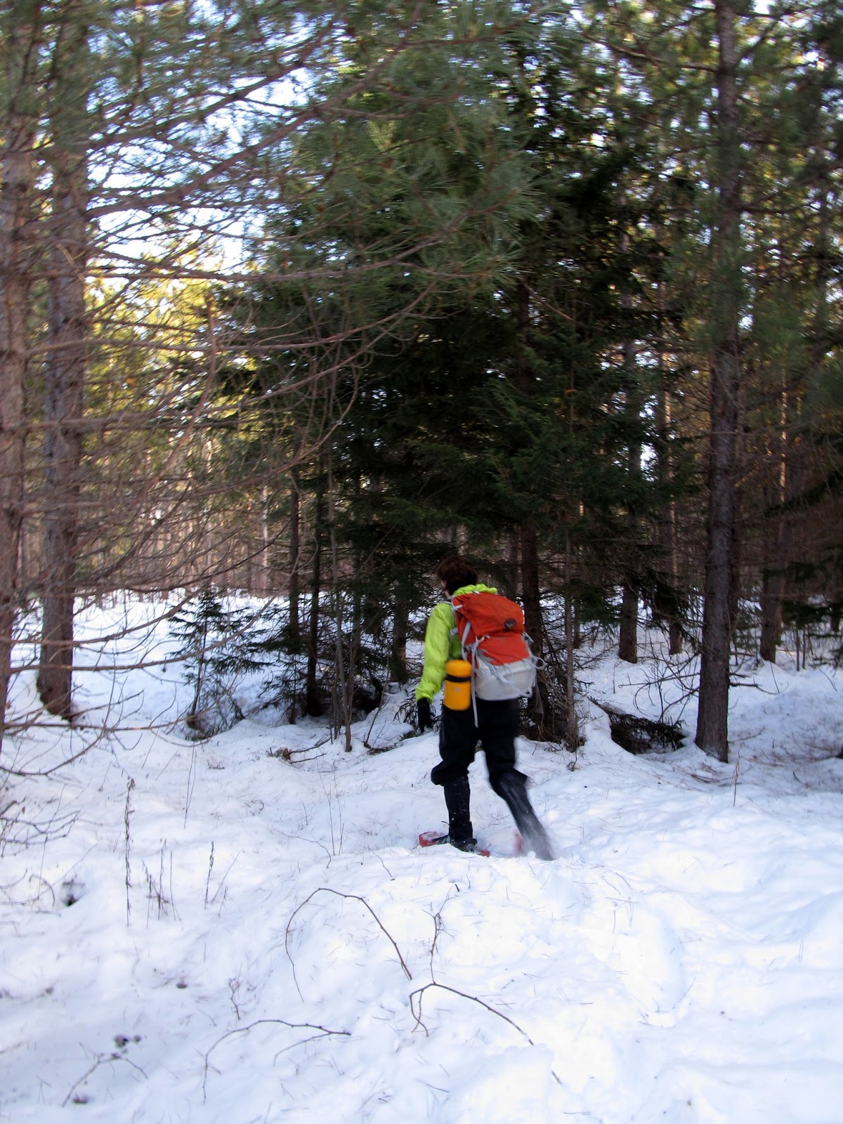
The lower section of the trails that we were on were nearly deserted.  It appeared that everyone skiing early in the day was on the mainline routes.  Nat, Kim and I slogged up the mountain, working our muscles back into shape after the long previous day (following a long hiking layoff).  We were soon treated to beautiful views  with undercast hanging over the valley and lakes.

Heading up the Green Weaver ski trail


Undercast in the valley


Undercast over Rangely Lake


Playing "dodge the skiiers"

Nat and Kim with the Horn visible back right

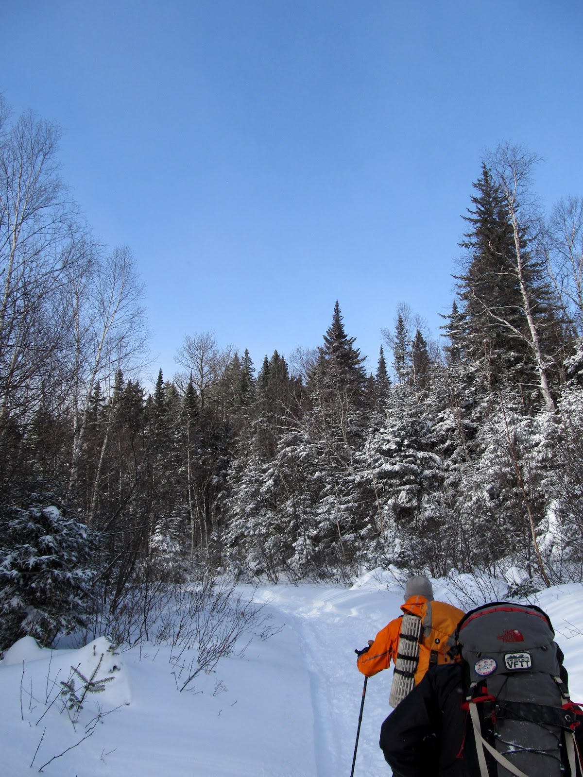
By the time we reached the lift area in the middle of the mountain, I was wiped out.  Nat and I started discussing whether we really wanted to make the effort to get over to the Horn or just call it good with Saddleback.  We kept heading up and figured we'd decide on top.

Plugging along


Nat looks happy to be out here

From the intersection we moved over to the Tri Color ski trail to the top.  This one has a couple of pretty steep sections, and even with the televators my legs were really complaining.  Clearly there is only one answer to this problem - hike more often!  We were soon at the top of the ski area and Frodo went in to check in with the ski patrol.  They had told us we needed to do this at the bottom, and that they'd send someone out to look for us if we didn't.  It was still beautiful and clear and there was barely a breath of wind.  We didn't stick around for long - just headed for the summit.

Rime near the summit

Frodo heading for the summit


Saddleback summit ahead


Frozen tundra


We're here! NE67 #53 for Nat and I

We stopped on the summit for a few minutes and soaked in the 360 degree views.  It would be hard to find a better winter day to be in a spot like this.  The visibility was easily over 100 miles, and we could see Katahdin bathed in sunlight standing out in the distance (although I wasn't smart enough to get that in a photo).  The summit ledges were pretty well blown off and there was just a crusty layer over a few inches of snow below that made walking easy.  Now it was decision time.  Nat and I looked at each other and said "sure, what the hell".  It's really hard to be up here and to not keep going.  We headed off and down into the col toward the Horn.

Heading for the Horn


The ridge to the Horn ahead


Through the porcelain trees


It's pretty steep coming off the summit and we were quickly down into the col.  There were a couple of slightly tricky sections, but nothing difficult.  The conditions were really good.  The only complications were a couple of spruce traps that I managed to find (including one earlier along the ski trail).  I did get a snowshoe stuck in one of these and Kim had to dig me out (after almost going in head first herself).  Other than that, the trek was pretty uneventful.  As we started down, we noticed what we thought was a hiker on the summit of the Horn.  After watching for a minute he seemed to be wandering around aimlessly.  We then realized that it was actually a moose!  Kim got a long zoom picture of him to confirm it (and we later found his tracks and "other evidence" on the summit).

Ice sculpture


Leaving Saddleback behind


Into the col

Frodo led the way across and the trail was easy to follow for the most part (even though there were no actual guides, and the rimed bushes looked like cairns).  We had one small area of confusion at the bottom of the col and I checked the GPS on my phone to see where we were.  The trail was only 20 yards or so away and after getting back on there the rest was easy.  By this time my legs were feeling good - I think it was the typical second day of hiking scenario where you go from dead tired to feeling great.  The climb up out of the col to the Horn went quickly and we were soon on top.

Nearing the Horn summit


The Horn summit sign and our return path beyond


Frodo, Nat and I on the Horn.  #54


Kim on the Horn

The ceiling was beginning to drop and the snow that was forecast for later in the afternoon was clearly getting closer.  The views hadn't diminished though, and we took it all in for a while before heading back.

Saddleback Jr ahead, Crockers, Reddington, Sugarloaf, Spaulding, Abraham beyond


Zoom to Sugarloaf and Spaulding - yesterday's hike


Time to go


The walk back to Saddleback was easy and the route was simple by following our tracks.  I was even able to avoid the spruce traps this time.  The rest of the day flew by.  It was snowing lightly by the time we got out of the col and the wind had picked up as we reached Saddleback summit again.  On the way down we made a stop at the warming hut for some hot tea and snacks and talked to some of the other skiiers and ski patrol folks that were there.  Once again, everyone here was so nice to us as hikers.  We flew down the ski trails and were down well before dark - no headlights needed today.

Beautiful walk through the col


Didn't we just come down from there?


The final steeps

Find Frodo


Missed our summit shot before.  It's a lot colder now


Back to the ski area


Study in white


This trip couldn't have turned out better.  Two awesome winter hikes giving us 4 Maine 4Ks in winter in two days and getting us to #54 of the NE67.  Better yet was a few days hanging out with a great bunch of people that are a big part of the reason that we love hiking so much.  We can't wait to get back to this part of Maine again and to share the trails with all of them again!


Here's the approximate route.  This is not a GPS track, but an after-hike attempt to plot the way we went.  There is an interactive version in Google Maps HERE


Friday, December 28, 2012

Maine Roadhouse Winter Week - Spaulding and Sugarloaf

On the day after Christmas we packed up and headed to Maine for what promised to be a great five days with good friends at the Maine Roadhouse.  This was our first visit to this part of Maine and we were really looking forward to some new territory and new mountains.  The conditions for winter hiking were looking great - the Stratton area had gotten 2-3 feet of new snow in the previous 10 days!

Nat, Kim and I left our house at 6:30am and with no traffic on this post-holiday day we breezed up and were at the Roadhouse before 1pm.  It was an absolutely beautiful winter day and we really wished that we'd planned things so that we'd be able to hike today, but it was a bit too late.  After getting unpacked and settled we decided to take a snowshoe walk in the woods across the street.  The caretaker said there was a good track on an unused road that ran along the river and we took his advice.  We had a really nice several mile wander in the snow - it was great to be back outside in the winter again!

Beautiful day when we arrived at the Roadhouse!

Beautiful afternoon at Nash Stream

Kim and Nat happy to be out in the snow

Kim breaking trail

Lovely spot by Nash Stream

Several more members of the group arrived after we got back.  We had dinner and planned our next day.  The weather was threatening to put a dent in our plans though.  The forecast was calling for more than a foot of snow beginning that night and getting heavier tomorrow.  We'd have to wait and see...

We woke up Thursday morning to about 5-6 inches of new snow and it was really coming down.  The forecast had been revised - now we were looking at up to 20".  Wow!  We were determined to get out though.  The plan was for a couple of people to cross country ski, a couple to downhill ski and a few to hike.  Saddleback looked like the perfect option - we could go together, split up for our individual activities and then meet up later.  There was just one hitch - when we got to Saddleback to check in, the mountain was closed due to the high winds that accompanied the snowstorm.

We asked the people at the ski area if there was anywhere around that we could go sledding.  One of them told us that there was a great spot at a local golf course.  We stopped into the local IGA and bought 7 new sleds - probably their season supply.  The hill at the golf course turned out to be great and we spent a couple of hours bombing down the hill in all sorts of interesting combinations.  By the time we were ready to go the storm had reached near blizzard conditions, but we all had a blast!

A couple of more people arrived on Thursday night after driving through the storm from Boston.  We spent the evening plotting possible hikes for Friday, which was forecast to be a nice day.  The general consensus was to go to Spaulding via a bushwhack from Caribou Pond.  With Caribou Valley Road snowed in this promised to be a really long day - 17-18 miles out and back in a couple of feet of new snow.  An alternate option was discussed with a car spot at Sugarloaf ski area to let us go across the AT to Sugarloaf from Spaulding and down the ski trails.  That would be shorter, but would mean breaking train for another couple of miles on the AT and more elevation.  We'd have to sleep on it.

We got up to a clear, crisp morning on Friday and reconsidered our plans.  MEB had come up with a great alternative.  We could spot a car at Sugarloaf ski area and start from Sugarloaf Golf Course.  There is a golf cart bridge that crosses the river and leads to an open bushwhack that comes into CVR about 2.5 miles in, letting us cut 4-5 miles off the out and back hike.  Perfect.

We did the car spot and got on the trail a bit after 9.  We were hoping that the snowmobilers had already gotten to CVR and packed it out for us.  We headed out onto the golf course and easily found the bridge.  It took us about 30 minutes to whack across to CVR and the going was pretty easy (at least for those at the back of the line - breaking trail in the new snow was hard work for those up front).  The one stream crossing was frozen and the only obstacle was one steep bank that we had to haul ourselves up.

Packing up for a long day
(Photo courtesy of Steve LaRocca)


Heading out from the Sugarloaf Golf Course lot


Golf cart bridge over the Carrabasset River


Lots of new snow!! (20" yesterday)


Carrabasset River


Hauling ourselves up the bank after the stream

When we came out on CVR we found that the snowmobilers had beaten us there and had packed it out into a nice white highway.  At least this part of the day would be easy walking - a 4.5 mile stroll to Caribou Pond.

Kim and Nat on Caribou Valley Road


One of the friendly snowmobilers that broke out CVR for us


A few adjustments


MEB and Brett


Frodo and Christine


Up the road


Spaulding coming into view


Blue skies!


Perfect day


When we got to Caribou Pond we stopped for a lunch break to get refueled.  It was already after 1pm and we had a long way to go.  Heading down the left fork of the road for about a 1/4 mile we found the beginning of the bushwhack.  Frodo had done this route before, but not in winter.  In theory it was a pretty open 1/2 mile or so to whack up to the ridge and run into the AT which we could then take the rest of the way to the summit.  The leaders picked the line and we headed in.

This way... Uh, really?


Easy bushwhack if it's all like this


OK, maybe not THAT easy...


Still beautiful in here


A few nice clearings


The lower part of the bushwhack was really pretty easy.  Nothing too tangled and a pretty gentle slope.  This is of course taken from the viewpoint of the back of the line - breaking trail and route finding at the front was presumably a tad more difficult.  There were a few open areas along the way where we thought we might have hit trail or logging road, but that turned out not to be the case.  We kept slogging through the 'whack and up some steeper sections for what seemed like a long time to go 1/2 mile or so to the ridge.  I purposely didn't look at my watch - just kept following the tracks up.  When we emerged onto the trail it had taken us a bit over 2 hours!  The good news was that we had come out almost exactly at the summit!!  We all went up to tag the top and took a quick break to get some hot tea and snacks before heading out again.

Porcelain trees - must be near the ridge


Nat and Steve-O at the top of Spaulding


Spaulding for #51 of NE67


Everyone was in agreement - there was no way we were going back down through the woods - it was onward to Sugarloaf.  As we came off the top of Spaulding we got our only real views of the day.  Pretty spectacular for a "viewless summit" though.

Only views of the day as we head off Spaulding.  Worth the wait!


We followed the AT across the ridge.  It was pretty easy to follow for the most part as the blazes were still above the snow line.  There were a couple of spots that we lost it temporarily but each time found it again in a few minutes.  The afternoon was wearing away and the light was getting dim as we approached the Sugarloaf spur.  Being 9 miles in at this point and not having hiked anything serious for a couple of months were taking its toll on my legs.  I really wasn't looking forward to that last 0.6 climb.  We soon hit the spur junction and headed up.  As we got closer to the top the light continued to fade and the wind started to pick up.  When we emerged on the summit we were greeted by very strong winds, blowing snow and almost complete darkness.  We could see the summit towers, but not much else.  Visibility was down to probably 50 feet.  I didn't take a photo at the summit (or along the ridge for that matter), but this is probably what it would have looked like if I had. (OK, slight exaggeration)


Now all we had to do was find the ski trails.  Easier said than done.  There was a little debate about which direction we should head, but Brett and MEB led the way.  I heard someone make a comment - "we're probably not going to die".  (I'm sure it was in jest, but I have to say that it was a bit of a nervous moment).

Happily, we hit the top of a ski trail about 3 minutes later - the line they picked was perfect.  We all stopped long enough to put on our goggles and headlights and then headed for the bottom.  We passed the groomer several times on the way down, but nobody gave us any grief about being on the ski slopes at this point.  Along the way the skies cleared again and the full moon rose through the clouds in front of us.  With the lights of the ski area below and the moon rising it was a really beautiful walk.  I never even considered trying to get a picture though - I was too intent on getting to the bottom.

The hike down was really quick.  We were back at the base lodge at 6:30pm - about a 9 hour day.  Our first hike of the winter (and our first Maine 4Ks outside of Baxter) had definitely been epic!  We couldn't have had a greater bunch of people to share the day with.  Thanks to the folks at the front of the pack that broke trail all day and led the way, and to everyone for the great company!  Can't wait to get out there with you all again!

Back at the car and ready to get back for dinner!

Here's the approximate route.  This is not a GPS track, but an after-hike attempt to plot the way we went.  There is an interactive version in Google Maps HERE