Happily our good friend Val was able to join us for the hike. It was great seeing her and hiking with her for the first time since Adams in July. We also have her to thank for turning this into a perfect triple (actually quadruple) peak day. She suggested that rather than Tom and Field we do Field and Willey and then based on time make a decision on Tom. Great idea!
We got an 8am start from Highland Center. The brook crossings at the beginning of the hike were a bit more interesting than usual due to the washouts from Irene. It was cold enough that all the exposed rocks were frozen so we took the approach of stepping on only submerged rocks. Really wasn't too bad and we all got across with dry feet. The trails down low (and for than matter all day) had just a dusting of snow and the walking was easy. As the Avalon trail started to get steep there was quite a bit of black ice but we held off on the Microspikes and skirted it until after the Avalon spur.
Nat and Val on the snow dusted Avalon Trail
Icy trail below Avalon spur
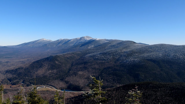
Presis lined up over Saco Lake
Long line of presidents
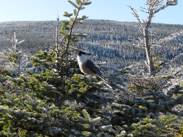
We did some summit sitting and had a snack. I think of all the places to just sit and gaze at the beauty this is one of my very favorites. As a bonus we had a pair of Gray Jays join us. This is definitely one of the places they love to hang out and it wasn't the last place we'd see them during the day.
Summit sitting on Mt Avalon. I feel like I'm being watched...
Ah ha! I was being watched.
And he brought a friend with him
Nat and Val
Nat and Mark on Mt Avalon
Sunshine streams down on Crawford Notch
There was a long day ahead so we pried ourselves away and headed up. As we got higher the frosting on the trees grew thicker and more beautiful. Snowshoes aren't always required for a beautiful walk in the snowy woods.
Soon after Avalon we gave in and put on our Microspikes and it made the going much easier as the trail got even more icy. I actually wound up keeping mine on for the rest of the day and it made for easy going. They weren't really needed at least half the time but it was easier than taking them off and on. We quickly made our way up to Mt Field and were treated to more of the beautiful views and our 31st 4000 footer summit.
More beautiful views from Mt Field
Did he follow us?
We're being watched again
Handsome little guy
Mt Field for #31
We headed out across the ridge to Mt Willey. The going here was easy with less ice than there had been on the Avalon trail. The views along the ridge were beautiful.
Views west along the ridge
Nat and Val negotiating some icy ledges
We arrived at Mt Willey summit, grabbed our summit shot and waited for the large group ahead of us that was having lunch at the viewpoint. While we waited our little friends showed up again.
Mt Willey for #32
Now I know he's following us
The viewpoint ledges on Mt Willey provide one of the most spectacular views that I've seen yet and an absolutely incredible perspective overlooking Webster Cliffs and up the entire Presidential range. We had the ledges to ourselves and took a long break for lunch (which we were 'forced' to share with our friends).
Presidentials lined up over Webster Cliffs
Beautiful look down Crawford Notch
Surveying his domain
Nat shares her lunch
So does Val
Oooh, oooh! Pick me, pick me!!
Nat and Val
Mark and Val
It was almost 1pm by the time we left Willey and it was looking like we'd have to forego Tom if we wanted to finish without headlamps. The going on the way up had been pretty slow and we'd lingered over all the views (which I never regret). We headed back across the ridge to Field and started making a quicker pace.
Heading back through the frosty forrest
More views along the ridge
When we got back to the Avalon Trail junction we made the decision to continue on the Willey Range trail. Even if we decided to skip Tom it was still new trail to see and only a few tenths more. As we descended from Field the trail (which is largely smooth ledge) quickly became a river of ice. With the Microspikes and some skirting of the edges of the trail it was easy going. It wouldn't have been much fun with bare boots.
Slippery sidewalk between Field and Tom
We were still making good time and it was 2:20 when we reached the Mt Tom spur. There were a number of other people at the junction preparing to head up. Everyone was dropping their packs to make for a quicker ascent and we did the same. We figured if we hurried we could get up and down in 45 minutes. One of the other groups suggested that we race to the top. We laughed and said we knew we'd lose. I'm not sure where we got the burst of energy, but we made it to the top in 18 minutes (and narrowly won the 'race'). We took a walk around the summit and checked out the views at the points where blowdowns have opened things up. This isn't as much of a viewless summit as it's made out to be.
Views back to Field before Mt Tom summit
Ice sculpture on Mt Tom
Mt Tom for #33 and the end of a fantastic day!
We headed back down and got back to the junction 40 minutes after we left - even with time to enjoy the views! I'm really glad that we didn't decide to skip this one when we were so close. I look forward to going back in the winter when the snow is deep and the views are even better. We grabbed our packs and headed down and made great time all the way. We were back at the trailhead at 4:30 and managed to avoid the headlamps by a narrow margin. What a great day! Thanks Val for suggesting this route and even more for joining us! I'm sure we wouldn't have had this great a day otherwise.
Nat's happy to be done!
Packing up to head down
Nat and Val negotiate the last of the icy trail on A-Z
This day was truly a bonus! We'd never expected to get a day another this year where we could bag three more peaks with aday trip from Rhode Island. With the holidays coming and lots to do this will certainly be the last trip of 2011, but what a great year it's been. After starting out with a winter where we never managed to make it up north we made up for it with 9 trips between the beginning of June and yesterday. All in all we bagged 15 new 4000 footers and 17 overall and had an absolutely wonderful time along the way! We're already looking forward to getting back up this winter for some fun in the snow and planning trips for next spring, summer and fall. We're keeping our fingers crossed that a few of these will work out to be more than just day trips (although those have been great too). If we don't have any more rambles to report in the next couple of weeks we want to take this opportunity to wish everyone a wonderful holiday season and happy trails in the new year.
Here's the journey in maps and aerials. There are more pictures here: http://bit.ly/tvh2q5


