
There is really nothing like being able to spend a couple of consecutive days hiking in the mountains. Just being out there is a treat. Getting to be on more summits in a short stretch is another benefit. This doesn't have to be strictly a peak bagging thing. The only thing better than being on a summit with beautiful views is being on a half dozen of them in a couple of days. And so it is with this hike.
As we've been winding down our list of the 48, I've had this hike in the back of my mind. The Wildcats and the Carters are all spectacular on their own, but combining them into a two day trip with a stay at Carter Notch hut (which is the only hut we hadn't visited to this point) is perfect. Admittedly June is mud and bug season, but I figured if we could manage to get up high on a couple of nice days it was worth the chance. I decided that the plan was to make a last minute decision the first time we got a two day window with as perfect a weather forecast as possible mid week (so that we could get last minute hut reservations and not worry about being shut out). Toward the end of last week the forecast for Monday and Tuesday was shaping up this way. No meetings scheduled for two days at work. Perfect! The plan is on!
As the weekend went on, the forecast improved. Sunny and upper 70s (almost too warm). On Sunday I tried to make the hut reservation on the AMC website and hit a roadblock. AMC reservations department is only open Monday to Saturday. Online reservations are not taken within one day of the time. Damn. I called the main AMC line at Pinkham to check our options. The guy who answered the phone asked me what our plan was and then proceeded to go ahead and take our reservation. He said that they try to accommodate people in this kind of scenario if possible. I really do love the AMC - they've always taken such good care of us. When he was checking availability at the hut he told me that they had 40 bunks open. No problem there. After I hung up I checked the info page for the hut. They have 40 bunks. Cool - a private stay!
We did a typical early morning drive up and were at Pinkham at around 10am. The plan was to leave the car there, hike over the Wildcats to the hut on Monday and then over the Carters and out at Camp Dodge on Tuesday. There is an AMC hiker shuttle from 19 Mile Brook to Pinkham at 3pm every day that seemed like the perfect solution. Worst case we'd hitchhike back to Pinkham - everyone is willing to pick up hikers in this area (right?).
Before the story continues, and if you've already decided that this is going to be too much of a tome, you can skip the rest and just go to the journey in pictures here: https://picasaweb.google.com/114856685929776719960/WildcatsAndCarters61112#
Almost all of the pictures are here though, so you might as well read on...
It was a beautiful morning for a hike. Blue skies, puffy clouds and a cool breeze that would hopefully keep the bugs at bay. We had decided to avoid the Cutler River crossing at the start of the Wildcat Ridge Trail by taking Lost Pond. It was easier anyway since we were leaving the car at PNVC. The mile across the Lost Pond trail went quickly and we enjoyed the bonus views along the way.

Looking up to the Wildcats from PNVC. Hope the sign isn't trying to tell us something.

Looks like a couple of days of white blazes ahead

Heading out to Lost Pond trail

Mt Washington rising above Lost Pond

Bunchberries were our constant companions

Time to head UP

Checking out the Cutler River crossing we would have had
The Lost Pond trail is flat (although there are plenty of boulders to climb over and around) so we got our legs warmed up in the first mile. Good thing, because the Wildcat Ridge trail is pretty much unrelenting all the way up to Wildcat E. A combination of steep rock, steep steps and steep ledges is pretty much the description of the whole thing. Did I mention steep?

White blazes lead the way up

Typical Wildcat Ridge trail (although this hasn't gotten steep yet)

Views over Boott Spur from the first ledges

Fun scrambling

Carved trail up the cliff

Gotta' hang on in here!

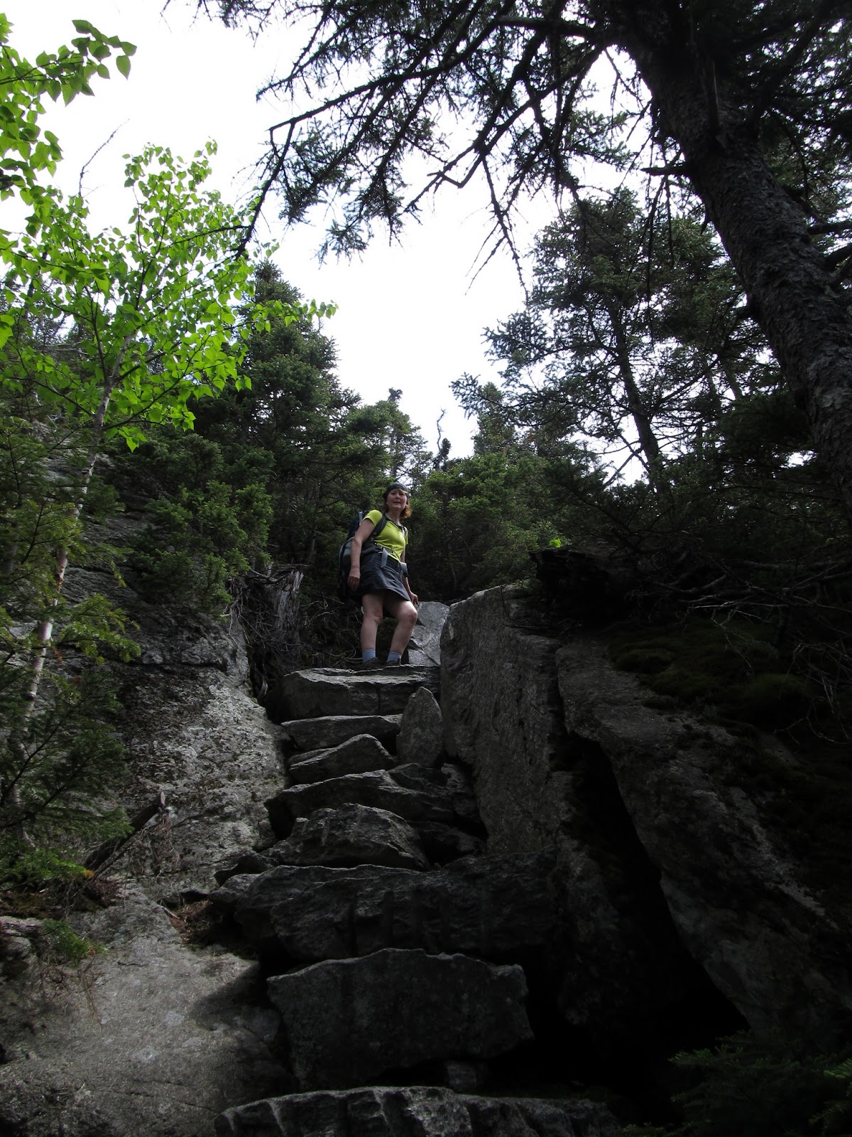
Nat winding her way up the cliff
On one of the sets of ledges we met a group of young guys from Boston that had started a little behind us and caught up to us. They were the only ones we saw on the trail all day. We continued up along the cliffs and after what seemed like a really long climb the trail moderated a bit and we got to Wildcat E.

Nat admires the Mt Washington views

More steep scrambling

Northern Presis coming into view

Looks like a Wildcat ahead.
Haven't seen any "Wildcat mating" signs so guess we're OK to go on

Another fun ledge

Lichen garden

Interesting steps
Another kind of steps

Adams and Madison in full view

Labrador Tea beginning to bloom

Going up! (Hey, who took this picture??)

This angle explains why the stairs

Good to have sticky boots!

Looking down over the route so far

Really? Some flat trail? Must be close to E peak.
We passed E peak without really knowing where it was. No matter - this isn't an official 4000 footer and we were enjoying the hike way too much to care. We soon emerged at the top of the ski area and took in the intrusion of technology in this otherwise incredibly wild area.

At the top of the ski area past E Peak

In case we didn't know where we were...

Looks like the aliens have landed! Maybe looking for Wildcats?

Ravine views

Nice spot for a picnic

Not sure we want to wait that long

Ah, great tip. We'll go this way

Looks like the half way point
After leaving E peak it was a quick walk up to D and the first official 4000 footer of the trip. We took advantage of the observation platform to soak in the amazing views. I really want to get up here in winter (although I'm not so sure about that climb).

Layers of mountains

360 Views

Wildcat D makes #38

Enjoying the day!

Looking to the peaks ahead
Heading down into the next col, we were off to the very long walk over the next two 'Cats to get to Wildcat A. The White Mountain Guide says that this hike is deceptive and to not go by the distance and elevation gain stats to judge it. Boy, are they ever right. The entire hike (including the easy mile on Lost Pond) is under six miles to the hut. It's definitely the longest six miles I've ever experienced. I'm not complaining mind you - it was a really great day.

Heading down into the col

Nice ridge walking

Lots of these guys on the trail

Seems strange to find bogs on the mountain ridges. Lots up here though
When we arrived at Wildcat A our next mission was to find the actual summit. It needs to be officially tagged after all, right? We had left the WMG trail description that notes the true summit location in the car so we had to do a bit of guessing. But first, we followed the sign...

Guess we should go this way

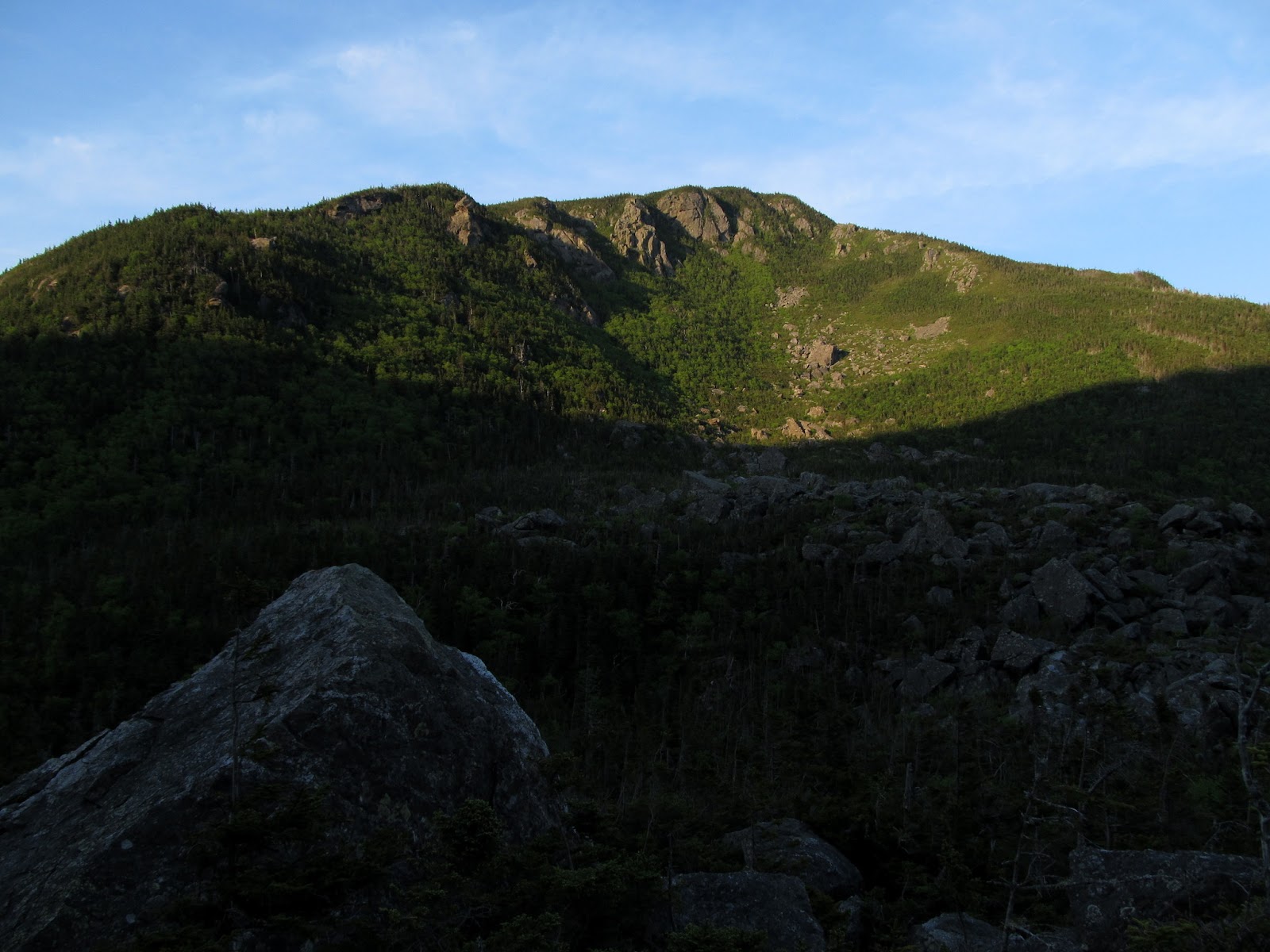
First look down into Carter Notch from Wildcat A ledges

Carter Dome over the notch

Carter Range stretching out

Nat stretching out :)
After soaking in the incredible views into the notch we went back to hunt for the summit.

Just in case this is really the summit (it's not)

Is this really the summit?

Really?

Guess this is it.

Wounded by the summit bushwhack

We'll use this for our summit picture. Wildcat A for #39
It was already 4:30 and we still had the steep descent to get to the hut before we could kick up our feet and relax. My knees didn't enjoy the way down, but the grade on this trail was nowhere near as bad as I expected. Certainly nothing like the trail coming up the other end of the ridge.

Time for the final descent of the day

Heading across the slide

I'm hiding - you can't see me

Run away!

I'll hide under here.

Almost there!

Final stretch to Carter Lakes
We made our way around Carter Lakes to the hut and marveled at the incredible scale of the Wildcat and Carter walls rising above us. The lakes were beautiful and we'd come back to explore later, but now the goal was to check in and relax before dinner.

Upper Carter Lake

Lower Carter Lake

Home for the night
The hut croo greeted us and checked us in. We were indeed the only guests for the night. There were only two benches brought into the dining room and the had the table set for two. We felt like we were in a private resort. There are two bunkhouses separate from the main hut with 10 rooms (4 bunks to a room). They told us to pick whichever room we wanted and settle in. Dinner in 45 minutes. Ahhhhh.

Cell phone service here is better than at our house. Go figure

Home sweet hut (our bunkhouse)

Carter Dome from the porch of the bunkhouse

Nice - a private room!

Nice view from the bunk

Well, look what Nat had in her pack.

Yup, that's a corkscrew. Hand carved by my resourceful wife :)

Our private dining room. Table for two please?
We enjoyed a glass of wine before dinner (thanks for carrying that up for us Honey) on the porch of the bunkhouse and enjoyed the view of Carter Dome - the start of our next day. The croo had made an incredible dinner for us and did the full service deal just like the hut was full (except better). A bowl of delicious homemade turkey soup was followed by a salad, amazing home baked sweet white bread, green beans with sesame seeds, rice and the most delicious Dijon chicken that I've ever tasted. We ate until we were stuffed, and felt bad sending the plates of food (that held enough for at least 6 people) back to the kitchen. I'm pretty sure that the croo didn't let anything go to waste. We finished our glasses of wine and were making a cup of after dinner tea when the croo came back out with dessert - baked apples filled with brown sugar and walnuts. Yum! There is nothing better than finishing a long, tough hike and sitting down to an amazing home cooked meal. We do love the huts. We finally dragged ourselves up and back to the bunkhouse. We finished our bottle of wine on the porch and then went out to do a bit of exploring around the lakes and the piles of huge boulders that make up the Ramparts in the notch.

Carter Dome reflection

Sunset over Wildcat A

Nat exploring Upper Carter Lake

Pulpit Rock (center)

Pulpit Rock

Wildcat over the bunkhouse

Nat exploring the boulders

You feel pretty small in here
The Ramparts and Carter Dome across Lower Carter Lake
We were pretty exhausted and tucked ourselves in early. We had gotten books from the hut library, but I don't think either of us made it through three pages before falling asleep. The sounds of the peepers lulled us and we slept like babies with the cool breezes blowing through the windows.
I woke up early (as usual) and went out for a walk down to the lakes. The morning was beautiful.

Beautiful sight to wake up to!

Wildcat A (left) high above the lake
Breakfast was at 7:00 and the table for two was once again ready. Coffee, cranberry juice, oatmeal with brown sugar, nuts and pineapple (my favorite) was followed by scrambled eggs with onions, peppers and cheese, bacon and homemade blueberry muffins. It's a good thing we were preparing for another long hike to walk all this off! We reluctantly dragged ourselves out again and said goodbye and thanks to the croo for taking such good care of us.
We got our packs together and were on the trail by a bit after 8:00. Heading up the Carter-Moriah Trail from the notch is a tough way to start the day. 1500' in 1.2 miles to Carter Dome. Our legs felt good though (we always seem to find our "trail legs" on day two of a hike) and we made it up quickly. The views from the ledges down into the notch were amazing.

Going up...

Starting up Carter Moriah trail to Carther Dome

No warm up time allowed. Steep!

Lots of ledges

Clintonia (Blue Bead Lily)


Hazy views through Carter Notch from the first ledges

Carter Lakes and the hut below
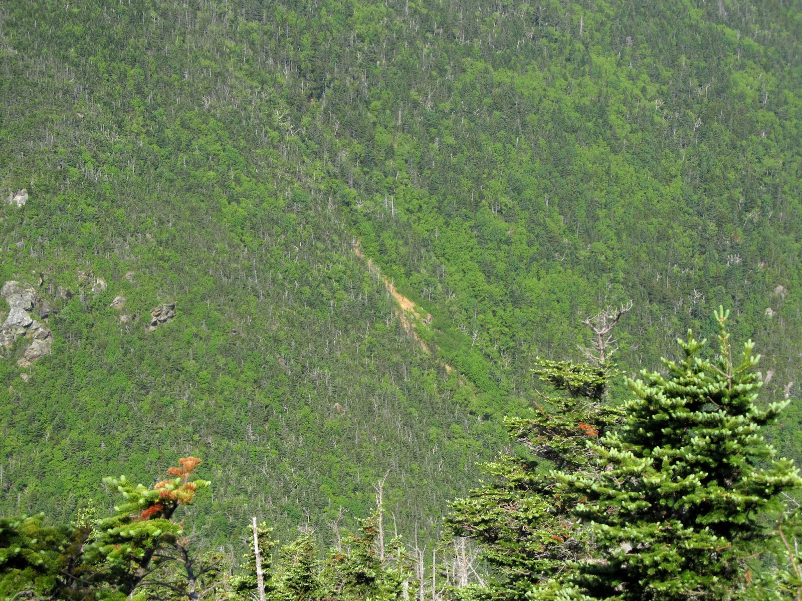
Slide (center) we crossed on the way down yesterday

Pulpit Rock

High above the notch

Great way to start the day!
As we approached the summit of Carter Dome we once again were on a summit hunt. The big rocks? The cairn? That spot across the way? Let's touch them all to be sure.

Approaching Carter Dome

Taking a break on Carter Dome

Carter Dome summit shot. Wait, maybe not...

Carter Dome for #40
After a nice break and a snack on the summit (yes, we already worked off that huge breakfast) we headed out for the remaining peaks. Next stop, Mt Hight. I can't imagine why anyone would skip this peak (even though it doesn't 'count') with the incredible views it offers.

Mt Hight and more Carters ahead

Mt Washington in the haze

Northern Presis are over there somewhere

Goldthread was lining the trails everywhere


Think we'll take the right fork...

Labrador Tea
The morning had gotten very warm, the humidity was about 110% and there wasn't a hint of a breeze. Not your typical spring high altitude day. It was basically like walking in a steam bath. The lack of breeze had also brought the black flies out in droves. You couldn't stop anywhere without being swarmed. Unfortunately for her (and fortunately for me), Nat is always their preferred target. At the end of the two days I counted three bites. She got disgusted and stopped counting somewhere past 20. One of the only places all day with a little breeze was the summit of Mt Hight. The bugs paid no attention to this though, and they were the thickest here of anywhere all day.

Nat reaching the summit of Mt Hight

All the Northern Presis lined up

What views! Need to come back here on a clear day for sure

More Carters ahead

Contemplating ants?

Doing the "black fly dance"

Bugs? What bugs?
The views were amazing, for what we could see through the haze. I'm sure that we'll be back here again on some crystal clear fall or winter day, and will fully appreciate how great they really are. The bugs chased us off the summit after a short stay and we dropped back down into the trees and headed to Zeta Pass.

Rosy Twisted Stalk


Zeta Pass


While taking a short break at Zeta Pass we ran into our first other hiker of the day. He had just finished a loop over Carter Dome and was on his way out. We discussed the options for a quicker exit in order to make the hiker shuttle, as we were already getting behind. We wound up deciding that the original plan of going out the Dodge Cutoff was the best bet. We said goodbye and headed out. Over the next mile we met two more solo hikers and these were the only signs of other life we saw during the trip. This is a very peaceful place. Now off to the next peak...

Following the bog bridge highway


South Carter for...

#41
We had one peak to go before the long descent. We headed up toward Middle Carter with the bugs, heat and humidity getting tougher and our legs getting weary. This may not be as tough a hike as the Wildcats, but it was still a long, tough day. Just one last climb...

Not finished going up yet

Slogging up the ledges

Middle Carter ahead - still looks like a long way

More hazy views

Mountain Cranberry


Rhodora


Rhodora lined path

Presis spread out on the approach to Middle Carter. Oh, for a clear day!
And then, we were there - and the answer was revealed!

The answer to life, the universe and everything? Middle Carter!

Middle Carter for #42 (which is of course the answer...)
So this was it. Five more peaks 'notched' on the list. Now all we have to do is walk down 4.6 miles and then get back to the car. Piece of cake! Wait - down? I hate down! My knees are tired! Oh well, onward...

Nat leading the way down from the final peak in an amazing 2 days

Beautiful bog

Four miles to go. All down. Oh my aching knees

Trail or brook? Perhaps both.

Another handsome guy
The North Carter trail is only 0.8 miles, but it was seeming to go on forever. I was beginning to wonder if we'd actually passed the Imp junction and just missed it. I finally gave in and turned on my phone and brought up the GPS for the first time of the day. We were only 3/4 of the way down North Carter trail. Ugh! We slogged on and got to the final junction - the Imp Trail - at 2:30. Any chance of making the hiker shuttle was long gone. Now it was just put one foot in front of the other, walk out, and hitch a ride back.

After about another 1/2 hour I finally just gave up and sat down. I was totally beat and just couldn't figure out why. We'd done many much longer hikes than this that hadn't tired me out nearly this much. Heck, even Owl's Head a few weeks ago was easier. I decided to try some food for an energy boost. I ate an apple and a few big scoops of peanut butter and drank about 1/2 liter of water. We got up and started back down and within 5 minutes it was like I'd had a shot of adrenalin! I thought I'd been eating and drinking plenty all day, but apparently I'd just run out of fuel and bonked. The rest of the way down I felt like a new person and could have walked another 5 miles. Good thing since we almost had to.
In what seemed like no time we'd made the turn to the flat section at the bottom of the Imp and started keeping watch for signs of the Dodge Cutoff. I knew it was shortly after a brook crossing and looked like a logging road crossing the trail. I hoped it wouldn't be too hard to find. When we got there, it couldn't have been more obvious if there had been a neon sign. We turned out and were soon out to Rt 16 and on our way home. Maybe...

Home stretch

Brook crossing just before Dodge Cutoff

Pretty cascades

Dodge Cutoff turn on the Imp Trail. Pretty hard to miss this.
The day's adventure wasn't quite over. We were 5 miles from our car, and all we needed was to get someone to pick us up. Two 50-something year old presumably not very intimidating people wearing backpacks. Everyone picks up hikers here right? So we start walking toward Pinkham and turning to stick out our thumb as each car passes. Many averted gazes. A few speed-ups to get past us quicker. One driver actually waved to us as he sped by. I resisted the temptation to wave back in a slightly less friendly manner. Almost 1/2 hour and at least 100 passed vehicles later we were approaching the Auto Road. Finally a pickup truck driven by a very nice young man put on his signal and pulled up in front of us. He said he'd be more than happy to give us a ride and apologized for the fact that the back seat of his crew-cab pickup was cramped. Are you kidding!? A cramped 5 minute ride vs. another 4 miles or so of walking?! He told us he simply couldn't believe that nobody had picked us up before him. Neither could we. He dropped us off at Pinkham and we thanked him profusely (and I told him that he'd restored my faith in human nature).
And so the adventure concluded. We stopped into Pinkham and washed up and then stopped at Dairy Queen in North Conway for dinner. I can't imaging anything tasting better at that point (even another hut dinner). It was a long and somewhat late drive home, but it was worth every bit of effort and small aggravation. We'll definitely visit these peaks again (like so many others that we've fallen in love with on the first visit). I can't believe that we're now down to 6 remaining peaks on the list - just 4 more hikes and it's done. The good news is, there are lots of other lists and LOTS of other mountains.
And now I'm off to pack for our next trip. We leave tomorrow for another weekend in the Whites and a stay at Crag Camp. It's promising to be a real Presi weekend. I can't wait to get back up on high!!

Route Map

Overhead aerial view

Full route seen from the northwest

Full route from the southwest

Carter Notch (Wildcat left, Carter Dome right)

Carters
If you're still confused by the answer to life, the universe and everything then you're clearly not a Douglas Adams fan or a geek (both of which I certainly am). So here it is:
From the Hitchhiker's Guide to the Galaxy -
Answer to the Ultimate Question of Life, the Universe, and Everything (42)

In the first novel and radio series, a group of hyper-intelligent pan-dimensional beings demand to learn the Answer to the Ultimate Question of Life, The Universe, and Everything from the supercomputer, Deep Thought, specially built for this purpose. It takes Deep Thought 7½ million years to compute and check the answer, which turns out to be 42. The Ultimate Question itself is unknown.