Pages

Thursday, August 12, 2010

Sweet Osceola Thursday - 8/12/2010

With everything else that's been going on this summer our opportunities to get to NH have been more limited than usual and no extended stays other than the 4 day Seek the Peak weekend. Our current solution to this dilemma is to try to grab several day trips between now and the fall. I've got the good fortune to be able to take vacation days with last minute notice so we can hopefully plan good weather days as well. Yesterday certainly worked out perfectly as one of those days.

We left the house at 5:00 and were at the Mt Osceola trailhead on Tripoli Rd a little after 8:30. The air was cool, the sky was blue and sunny and it was about as good an August day for hiking in the Whites that you could ask for. We only saw a couple of others on the trail all the way to East Osceola and we had both summits to ourselves to enjoy in solitude. The hike was awesome, the views were spectacular and our plan to do a few more of these in the coming weeks were solidified! At 3:00 we were back at the car and ready to head home.

The drive home put a bit of a damper on our good spirits. We've avoided the weekday trips in the past because of not wanting to deal with the horrendous Boston traffic. On the last trip up in July we had finally realized that we could avoid Boston rush hour mess by using 495. Yesterday, not so much. There was an accident on the other side of 495 that had a rescue helicopter landed on the highway and traffic stopped in the other direction for over 10 miles. The rubbernecking traffic on our side wasn't much better. In the end it probably only cost us an extra 1/2 hour and we were home before 7:30. An aggravating end but not enough to ruin a fantastic day. Already thinking about another one of these next week...

Rocky trail heading up Mt Osceola


The reward on Mt Osceola summit. What incredible views!


Great way to spend a Thursday


The path ahead to East Osceola 


Steep climb down the chimney bypass


Amazing views into the Pemi


On the summit of East Osceola. Not great views (OK, no views) but a nice spot to enjoy lunch in the dappled sunshine and cool breezes


Fun climb up the chimney on the way back


This poor little vole almost got squished when he ran across the trail under my feet. He ran in here and just sat there "being invisible".


The whole album is here: http://picasaweb.google.com/mtruman42/Osceolas81210#

Monday, July 26, 2010

Seek the Peak Weekend 2010

I know that I'm really late in getting this posted but it's been really busy since we got home Monday. Probably would have been sooner if I hadn't been looking at everyone else's wonderful pictures from the weekend.

This was our third Seek the Peak and probably the best yet. So great getting to participate in these and being able to help the OBS. The success of the event this year was amazing!

Since we didn't have an extended NH vacation planned around STP this year as we have in past years we decided to stretch the weekend as much as we could with some extra hiking (and socializing). We camped at Moose Brook again this year and it was great.

We left home early Friday morning to give us time to get in a warm up hike before going to the registration and then setting up camp. Our warm up was the Sugarloaves in Twin Mountain. This is a great little 3+ mile hike with beautiful open ledges on both North and Middle Sugarloaf and amazing views. The weather Friday was great and we stood on the ledges gazing at the Presidentials thinking of the friends that we knew had taken advantage of the nice day Friday to get in their Seek the Peak hike and avoid the likely bad conditions Saturday. We met a new STPer on Middle Sugarloaf (Armando) and shared our Saturday plans. It was good to see this new friend along with all our old friends the next day. 

Nat on the ledges on Middle Sugarloaf


Beautiful in the Presis today


We'll be up there tomorrow!


After our hike we headed to North Conway and Flatbread Pizza for lunch before registration. Right after sitting down Chris, Cindy, Tim and Val all just happened to arrive as well and we enjoyed a nice lunch together. Great start to the weekend's social activities. We went back and set up camp and turned in early. Listening to the rain on the tent overnight didn't leave us very encouraged for the conditions on Saturday...

Saturday morning we were amazed and happy to see the sky clearing and by the time we arrived at Pinkham the skies were mainly blue! Ryan has once again earned his position as official STP forecaster  

We hiked with Tim, Val, Debi and Will (Debi's 11 year old son). It was a great treat for us to be able to hike with Will on his first trip up Mt Washington and his 9th 4000 footer. I have no doubt that he will finish his list before we do. It was a great hike up Lion Head and the skies were clear till we reached the Alpine Garden. I was sorry that the summit was in the clouds since it robbed Will of the amazing views up ther (but I'm sure he'll be back). We skipped the tour this year but snuck downstairs for a few cookies before heading back down. The hike down Tuckermans Ravine was beautiful with the sun emerging as we reached the top of the headwall. The streams and waterfalls were gushing and the flowers were amazing. 

On the trail and on the summit we ran into many of our forum friends. So wonderful getting to connect with everyone in person at least once a year! Another great after party capped with the announcement that we'd raised $200,000 this year. Fantastic!! Saturday night we hung out with a bunch of our friends at Kevin's site at Moose Brook (thanks Kevin and Judy). Hard to imagine a better day in the mountains.

Clear skies over Pinkham to start the day!


Ready to go


Will gets his first look into Tucks. Look at that smile!


Beautiful clouds and undercast


Heading into the clouds above Lion Head


Limited view on top


The gang heading down Tucks


The ravine "water gardens"


Our crew taking a break at HoJo's


The longest 2 miles


Sunday Tim and Val suggested we get in another hike (Mt Moriah) which sounded great to us! We weren't quite so sure how our legs would hold up to another 10 miles but it turned out to be just fine. We took the Stony Brook trail up and it was great. The first two (and last two) miles are mostly soft walking on nice smooth trail covered in pine needles - very unlike typical White Mountain trails and very welcome after the finish on Tucks the day before. The hike was really nice with more than a mile of beautiful ledge walking leading to the summit. The clouds rolled in and rain threatened but we never got wet. We finished tired and happy to have #17 checked of on our 4000 footer list.

Nice soft trail!


Why the trail is named Stony Brook (that's the trail in the middle)


Lots of ledge walking like this


And quite a bit of this


On the summit of #17


The Carters in the distance on the walk down


Stony Brook


We had considered the possibility of one more hike before heading home on Monday and had been thinking that with the long range forcast that Mt Jefferson might be good. Between the final forecast of winds up to 80 MPH  and the tired legs from the previous three days we opted for a scenic drive instead. We headed out of Gorham and over to Rt 113 for the beautiful drive along the Maine border through Evans Notch and then across the Kanc so the we could stop at the Woodstock Station for lunch. The views everywhere were awesome, the lunch was too and all in all it was the perfect end to a perfect weekend.

Field of fireweed along the road leaving Gorham


The Baldfaces from Evans Notch


Lily Pond on the Kanc


Beautiful mountain views on the Kanc


Thanks again to all the organizers, volunteers and others that make this event possible. It is great for the OBS and it's great for us participants as well. Already counting the time till next year.

Complete photo albums here:

Sugarloaves: http://picasaweb.google.com/mtruman42/Sugarloaves72310#
Seek the Peak: http://picasaweb.google.com/mtruman42/SeekThePeak10#
Mt Moriah: http://picasaweb.google.com/mtruman42/MtMoriah72510#
Evans Notch and the Kanc: http://picasaweb.google.com/mtruman4...ncamagus72610#

Thursday, June 24, 2010

Hetch Hetchy - Yosemite's Garden of Eden - June 2010

"Hiking - I don't like either the word or the thing. People ought to saunter in the mountains - not hike! Do you know the origin of that word 'saunter?' It's a beautiful word. Away back in the Middle Ages people used to go on pilgrimages to the Holy Land, and when people in the villages through which they passed asked where they were going, they would reply, "A la sainte terre,' 'To the Holy Land.' And so they became known as sainte-terre-ers or saunterers. Now these mountains are our Holy Land, and we ought to saunter through them reverently, not 'hike' through them. " - John Muir

After 4 days of crowds and traffic in Yosemite Valley (coupled with amazing sights and wonderful experiences) we decided to escape on the last day of our visit and go somewhere that we hoped was totally different. We were looking for a bit of solidude, some new sights and hopefully some of the wildflowers that are supposed to be everywhere in Yosemite in the spring and early summer (but which were conspicuously absent in the valley and the other locations we'd been). We decided on Hetch Hetchy - the place that John Muir fought to save during the last years of his life. Before the dam was built there in 1913 Hetch Hetchy was another valley similar to Yosemite Valley itself. The dam that John Muir worked so hard to prevent for more than 10 years created the Hetch Hetchy reservoir - "the catch basin of John Muir's tears". Muir never lived to see the dam built and his beloved valley flooded which may have been a blessing for him. As it exists today it is still an incredibly beautiful place and the reflections of the mountains and granite domes in the reservoir are spectacular scenes. I do wish that I could have seen it as it existed in 1900. It must have been a very magical place. Today we will saunter through it...

Hetch Hetchy is about a 40 mile drive from Yosemite Valley. As you enter the park at the Hetch Hetchy entrance (it is a disconnected portion of YNP) you begin to be transported into a new and very beautiful world. The roads are lined with wildflowers and every turn brings new beauty.


Hetch Hetchy valley with dam and reservoir in distance


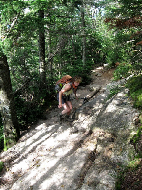
The path that we chose for our saunter follows the cliffs above the reservoir and goes past Tueeulala Falls (pronounced twee-la-la - I love that name) and then to Wapama Falls which at 1300' is as high as Upper Yosemite Falls and at least seems to have more water flowing over it. As we followed the trail through the tunnel on the other side of the dam the wildflowers began to appear. In the beginning sections the trail and surroundings were quite dry and the flowers were still a bit limited. 

The falls made by nature above the falls made by man


Water plunging into the canyon over the dam


Hetch Hetchy reservoir and Wapama Falls


Kolana Rock watches over Hetch Hetchy


Tueeulala Falls


Looks like we'll see some flowers...


As we went on we started to get into little wet gardens all around the trails from the many streams and runoff from the waterfalls. The wildflowers just exploded. One guidebook dsscription of Hetch Hetchy described it as "a riot of wildflowers in the spring". I don't know that this does it justice. By the time we were done I had counted (and photographed) 30 different unique types - most of which I had never seen and still haven't taken the time to identify. I just haven't felt the need as it seems like all this beauty really doesn't need to be named.


Further on we came to a beautiful spot where the stream runs over the rock and then down to the reservoir. We stopped and soaked our feet and soaked in the incredible views to Kolana rock keeping guard over the far shore and the mountains beyond the end of the valley. Sitting in this spot I was taken by the feeling that this was perhaps the most beautiful place that I had ever been. Truly a Garden of Eden.


As we went on the roar of Wapama Falls became stronger. Below the falls is a series of bridges where you can walk across through the "mist" (more like a torrential rain) that goes far beyond the soaking that the Mist Trail has to offer. It was a spectacular place and the soaking was welcomed as the afternoon had gotten quite warm.


We reluctantly returned the way we came, finding yet more wildflowers that we'd missed on the way out as well as new and beautiful vistas. I would love to come back to this place again and again and explore all of the vast area that we didn't begin to touch in one short day. We could not have found a better way to spend our last day at Yosemite. To the many nature and wildflower photographers here - if you ever have the opportunity, go to Hetch Hetchy - you'll be in heaven.


"These temple-destroyers, devotees of ravaging commercialism, seem to have a perfect contempt for Nature, and instead of lifting their eyes to the God of the mountains, lift them to the Almighty Dollar. Dam Hetch Hetchy! As well dam for water-tanks the people's cathedrals and churches, for no holier temple has ever been consecrated by the heart of man." - John Muir

If you haven't already seen it the report from the rest of the week is here: A Few Days In Yosemite

The complete Yosemite photo album for the whole trip including Hetch Hetchy is here: http://picasaweb.google.com/mtruman42/Yosemite2010#

If for some reason 400 pictures aren't enough for you here are the Monterey and San Francisco albums