
We were still sitting in the campground having coffee, enjoying the beautiful morning and pondering our options when our campground neighbors Tim, Val, Mark and Becca waved to us on their way out to join a group for their hike that day. We hadn't thought to ask where they were headed. We finally made our decision - Goose Eye and Carlo. This one had been on our radar for a while and it looked like a perfect day for it.
We packed up and made the short 35 minute drive from the campground. The WMG description for getting to the trailhead made it sound quite confusing, but the GPS got us to Success Pond Rd and the trailhead without any problem. We decided to do the loop clockwise, heading up Goose Eye, across the AT on the Mahoosuc Trail to Carlo and down the Carlo Col Trail to complete the loop.
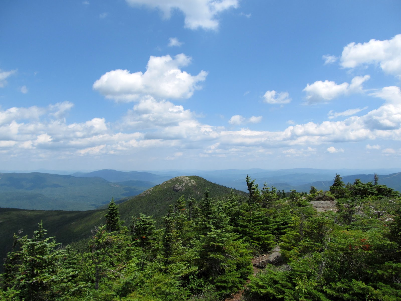
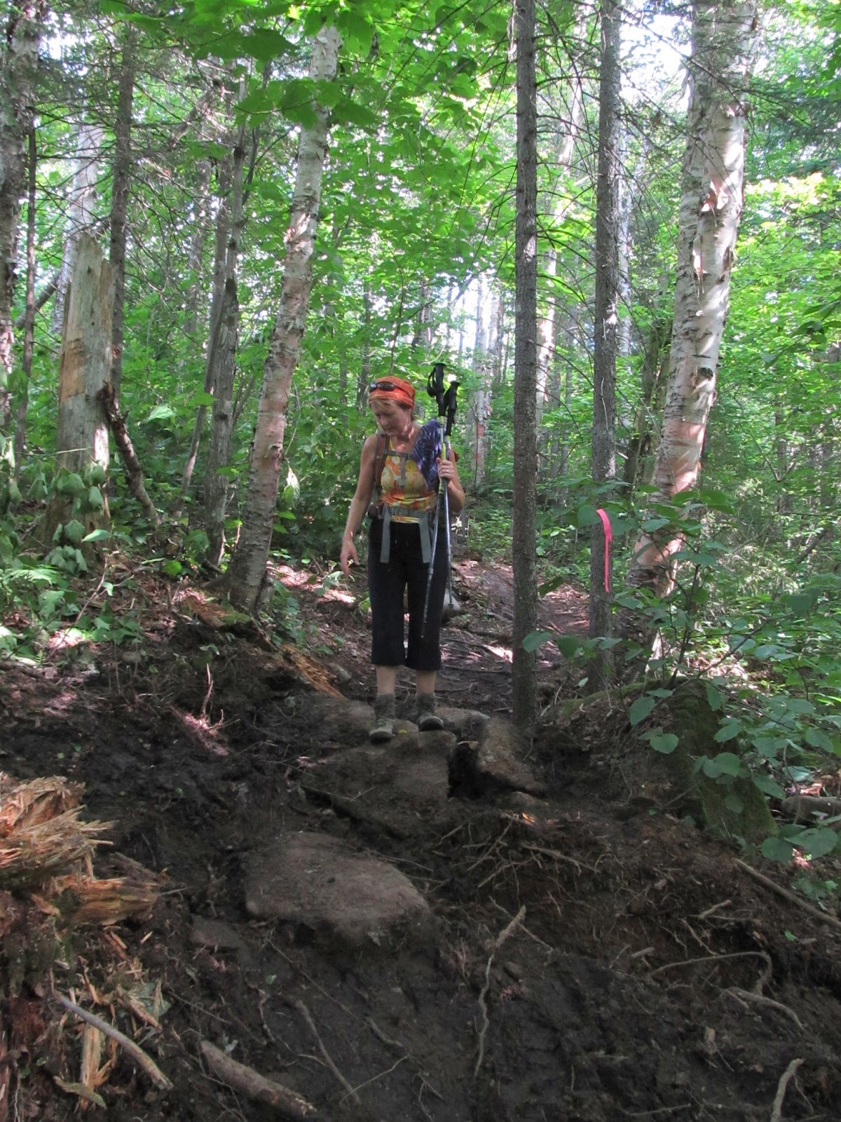
We headed down the logging road that begins the hike and quickly came to the turn for Goose Eye Trail. You have to pay attention in the lower sections as there are several places that follow stretches of logging roads and it can be easy to miss the trail signs where the trails enter and leave them. One of the first things we found was the character of the trails - soft and easy under foot - a contrast to the usual rocky trails in the whites.

Goose Eye in the distance as we start the hike in

Lovely streams and woods down low

Soft paths. I already love Maine trails

Prunella vulgaris - common heal-all
After a mile or so of nice woods walking the climb began. The grades most of the way up are fairly easy and the trails remain soft and smooth.

Nat coming out of the woods as we begin the climb

Magical forest
As we approached the summit the trail took a significant turn for the vertical. Lots of steep ledge and rock.

OK, I guess the trail is getting serious now

Lots of rock and ledge ahead
The scramble up the ledges continued and we soon came out of the trees and were treated to the amazing views.

Nat taking it all in


Ledges are getting steeper

A little help from the trees


Success Pond in the distance
From here to the top of the summit things were really steep. I was glad that we had gone up this way and weren't trying to scramble down this section. The climb was fun and we were soon on top and treated to the amazing 360 degree views.

Success Pond in the distance

Through the scrub

Up the ledges

REALLY steep to the top!

Views from the top across the Mahoosucs

Top o' the Goose
We hung out on the summit for quite a while enjoying the views and having lunch. Nat had packed hard boiled eggs today. Goose eggs perhaps?

Goose Eye East Peak beyond the main summit

Old Speck and the Baldpates bayond Mahoosuc Notch

The views from Goose Eye are definitley no goose egg


We reluctantly dragged ourselves up and headed off of the summit. We had been looking at the Mahoosuc trail winding across the ridge to the north and thinking how nice this stretch must be. Definitely need to get back and go that way in the future.
Goose Eye East Peak

Ready to head down

Mahoosuc Trail to Carlo

Heading off the summit

Where we've been...

Where we're goin'
The climb down from the summit on the other side was at least as steep as the one going up. There was a bit of assistance in the way of a ladder and some iron bars to make it passable.

Steep on this side too

Is that a ladder sticking up?

Sure is!

Interesting placement of blazes

Down the first part - now across the ledge

Is that bottom blaze for real?

Lets try the across route

Pretty narrow

Just a bit of a stretch

One big step down

A little more help on the next section
At the bottom of climb we had another hiker catch up to us. He turned out to be a SoBo AT through hiker that was finishing up his last days in Maine. He'd started about a month earlier at Katahdin and was really enjoying the trail. We hiked with him most of the way over to Carlo and really enjoyed hearing about his journey so far. Hope he has great luck the rest of his hike.

Heading down to Carlo Col with the SOBO through hiker we met a minute ago

More nice trail

Lots of granite sidewalk through here

Apparently this is the way they cut steps in the ledge in Maine

Looking back to Goose Eye from the col

Nat heading through the scrub. Beautiful section!
The section between Goose Eye and Carlo alternates between nice woods walking and beautiful sections of sub-alpine ridge. We thoroughly enjoyed it and were soon on the climb back out of the col up to Carlo.

And back up the ledges


Another steep drop. Just follow the blaze and jump?

Carlo summit

While the views from Carlo are not quite as spectacular as Goose Eye, they're still beautiful. We hung out for a short time and then headed down the back side on the way to the Carlo Col trail.

Looking south

Back to Goose Eye

More beautiful ridge trails

This way...
The top section of the trail down from Carlo col was more nice woods. We stopped by the Carlo Col Shelter to check it out.

Emerald green on the Carlo Col trail

Carlo Col shelter

Hot day today. Time for a little refreshmen

Interesting Cairn. What's that on top??
A good portion of the Carlo Col trail seems to have been rebuilt recently. Possibly from damage after hurricane Irene? Lots of mud through here now and a bit off the old GPS track, but easy to follow and not a bad walk. The mud could be a bit interesting after some rain though...
Looks like a lot of this trail was rebuilt after Irene

Nice new gravel steps

Back into the magic forest
We soon emerged on the logging road that makes the last half mile or so back to the car. It was a hot afternoon and there was nowhere to escape from the sun. We made our way down quickly, focusing on the ice cream that we planned to stop for on the way back to the campground. As we got back to the Goose Eye trail junction we could hear voices in the woods. We reached the junction at the same time as the other group and as they emerged from the woods we heard one of them say "hey, it's the Trumans!" To our surprise it was Tim, Val, Mark, Becca, Sabrina, Jeremy and Tracey with the trail doggies (Terra, Pemi and Nyx). They had gone up the Notch Trail and come across the ridge to the north and down Goose Eye. We might have even seen them on the ridge when we were on Goose Eye summit. What an amazing coincidence that we not only chose the same location, but actually came out at exactly the same time. It is indeed a very small world in the mountains.

Walking the road back to the car

Mark (the dog whisperer) Tracey, Pemi, Nyx and Terra

Where are you going Terra? Food's on the other side!
Our first venture into western Maine couldn't have been better. It was love at first hike! We just can't wait to explore more of it in the future.
Love the entire report! Your photos and narrative provide exquisite details regarding the hike. At times, I felt I was there hiking right along with you.
ReplyDeleteYour concluding statement about your first venture into western Maine was perfect, i.e. "It was love at first hike!"
John
Can't remember if I replied to you on FB about this John, but thanks for the comments and compliments. Always fun to share!
DeleteMark
I second 1HH's motion. Great trail report and photos. What beautiful mountains, the Mahoosucs, and every bit as rugged as their reputation suggests. I look forward to hiking them before long. :)
ReplyDeleteThanks Chris. This area is just amazing. You'll definitely love it.
DeleteMark
Looks like you had a great day. We wondered what that other peak over yonder was (do people still say "over yonder?"). Now what? Getting ready for Baldpate?
ReplyDeleteIt was a REALLY great day. Over yonder is just fine in my book. :) We definitely want to go back and do Baldpate and Old Speck. Lots of stuff going on before we have a chance for that though. Baxter for a week this month and three hikes to go to finish our 48. Several other miscellaneous events like getting our daughter off to college. A friend told me today that they're planning a Mahoosucs backpack for sometime this fall, so that may be when we get back. So many mountains, so little time.
DeleteMark
Mark, nice hike! You mention many of the same observations I made while in the Mahoosucs - soft trails, wild, and when it gets steep, it gets STEEP.
ReplyDeleteYou must have a car that can take on Success Pond Road since you didn't mention the roughness of the road...it's an adventure just driving to the trailheads further down in a smaller car.
Thanks Owen. The drive was indeed interesting. I was glad we had the Escape and not my car. We did it at about 20MPH on the way in and got washboarded to death. On the way out I did about 35 and it was better. Skimming the little ruts I guess. Just had to watch out for the big rocks and holes :-O
Delete