It had been coming for a long time. Two years ago when Nat turned 50 her birthday request was a trip to Baxter State Park. She wanted to camp, hike and just be there in general. But most of all she wanted to hike Mt Katahdin and do the Knife Edge. Life threw us a few curve balls that year and the birthday trip didn't happen. We tried to plan it again last fall and once again the stars refused to align. Several months ago when we got an invitation to this year's Baxter Bash we knew we would finally make it. We were both really excited about the trip and about this hike. My excitement was, however, mixed with a certain degree of terror. I had many times laughingly commented to people that Nat was going to drag my acrophobic butt across the Knife Edge. I wasn't laughing so much when I thought about it myself though. The guide books all say the same thing - "don't take this trail if you have a fear of heights". Sometimes there are reasons to face your fears...
As the trip grew close we watched the forecast. Bad weather is a much stronger reason to stay off of Katahdin than any other mental ones. The beginning of the week looked really good though. Tuesday looked like the best day, and in completely uncharacteristic fashion that forecast continued to hold. Mostly sunny, light winds and a very slight chance of thunderstorms. Doesn't get much better than that. The day was finally here.
The trailheads for Katahdin all offer limited parking and on good summer days there are day trip visitors lined up at the park gate long before dawn. Campers are allowed access to the trailheads as long as they are past the gate by 7:00am. We weren't waiting anywhere near that late. Everything was packed the night before and after getting up at 4:00 and having coffee and oatmeal at the campground we were on the road at 4:30. It takes almost an hour to drive to Roaring Brook from Foster Field on the 20mph park Tote Road. When we got to the lot at 5:30 there were several other cars already there and people beginning to hit the trail. We signed the hikers log at 6:00 - 2-1/2 hours after the first entry for the day at 3:30. Talk about your early starts! We headed down the Chimney Pond trail and quickly reached the turn for Helon Taylor, the main ascent route to Pamola Peak.

Ready to go

Me too (I think)

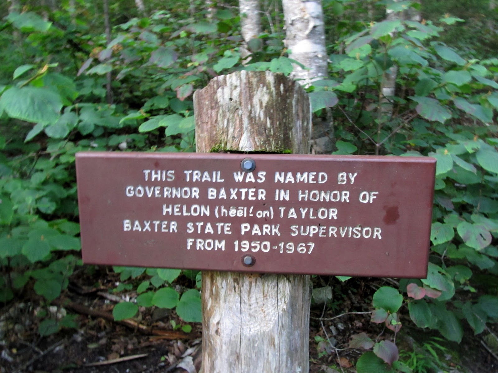
Just to be sure we know how to pronounce it
This route doesn't afford any warm-up time. It starts to climb almost immediately and just gets steeper all the way to Pamola. We took our time and enjoyed all the steps. We had all day.

Nice walk in the woods

Starting the rock hop. Peaks ahead

Mountain Holly

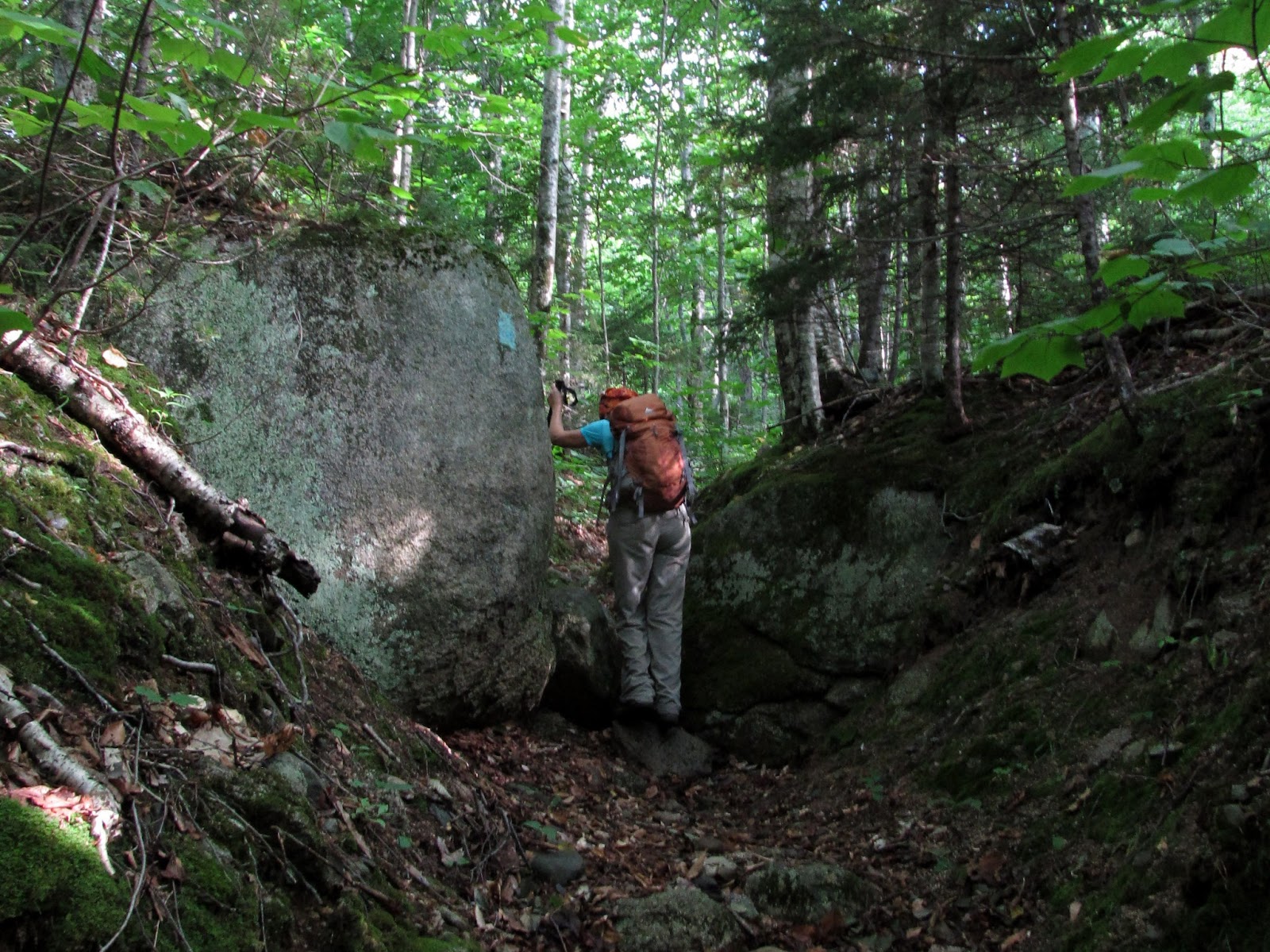
The boulder scramble begins
After some early rock hopping and boulder scrambling in the woods we emerged to the first views of the day. Pretty spectacular already, but nothing compared to what was to come.

First views

The Turners in the foreground and the Travelers in the distance

Cloud cap on Hamlin Peak

The road ahead
Once you emerge from the trees and onto Keep Ridge the views just get better and better. Helon Taylor is certainly one of the most beautiful trails we've ever walked.


Stairway to the sky


Cloud cap on the Travelers in the distance
Nearing the final stretch of the ridge leading to Pamola, the first looks at what we had been waiting so long to see for ourselves came into view.

First glimpse of Chimney Peak and the Knife Edge


Looking up Keep Ridge to Pamola


Final stretch
The final stretch to Pamola continues the rock hop, and for at least now leaves the boulder scrambling behind. As we neared the summit the thoughts and fears that had been plaguing me before this hike started to creep back into my head. What if I couldn't get myself to go across once we were there? Nat had told me she'd be glad to take another way down if I didn't think I could do it. I knew that she meant it, but that wasn't an option that I was ever going to really consider.

Creative blazing


And then we were there. You can't really see more than a glimpse of what lies ahead until you're actually standing on the summit of Pamola. No matter how many pictures and videos you've seen of this there is no way to be prepared for that first sight.

First real look at what's ahead from the top of Pamola Peak

Nat on peak #1 for the day and happy to be starting the section she came here for


Chimney Peak and the start of the Knife Edge
(person in the col past Chimney Peak shows the scale)

That's a LONG way down!

Knife Edge and Baxter Peak
We spent a long time on Pamola having lunch (can you call it lunch at 9am?) to fuel up for the next stretch and soaking in the views. It was finally time for one last very deep breath, and then to go for it. The first obstacle is the climb down the back of Pamola into Chimney col and the up the vertical face of Chimney Peak. I'd heard many stories about the difficulties of this section and they were mostly true. As you descend into the col there are several sections where you have to decide whether to inch down nearly vertical rock on your butt, or face into the wall to allow a better grip, but not see where you're going. I went first and got to the first of these sections and couldn't figure out what to do next. I was facing out from the wall and my pack and trekking poles were both getting in the way. My first step was to take the poles off and toss them to the bottom. Now I was committed, but still couldn't figure out the next steps. Nat came down behind me and we agreed that a spot to my left looked like a better option and she went past me and down that way. I took my pack off, handed it down to her and followed. The rest was easy.

Let the fun begin. Just 1.1

Chimney Peak

Nat getting ready to start the descent
We were down in the col, but now we had to get back out. The climb up Chimney Peak is steeper and longer. Most of it is really pretty simple though, as it has good hand and footholds. I again went first and easily got up the first half, and then came to the biggest obstacle of the day. There's one spot where there simply aren't any handholds to drag yourself to the next ledge. Thoughts of going back down crept into my head, but I knew that wasn't reasonable. Finally I managed to get my knee up onto the ledge and, in one very ungraceful lunge, dragged myself up. The rest of the way to the top was easy. I continued up, knowing that Nat, who climbs like a mountain goat, would be fine. Now it was time to turn our attention to the Knife Edge.

We have to go up that?


Nat comes up the final stretch of Chimney Peak

Pamola in the mist

Pamola

Pamola and the route down to Chimney col
I won't say that the Knife Edge was easy, but after the adrenalin rush going up Chimney Peak I felt that the worst was behind and somehow was calm about the rest. For the remainder of the way to South Peak it was basically a matter of hanging on to the rocks with the constantly good handholds and just moving forward. Based on advice from a friend, we had brought leather gloves to protect our hands from the rocks and they were a great help. As I said in the beginning, there was considerable crab walking and butt sliding, but there was never anywhere that I felt uncomfortable. In a few particularly vertiginous spots I simply focused on my hands and feet, but for the most part I enjoyed the simply breathtaking views all the way across. I know that Nat sure did! There is one spot where there is a ledge to traverse that is about the width of your boots with a sheer drop under you heels. Nat went across that easily, and thanks to the advice of some friends that had done this route recently, I simply avoided it and went around this section on the other side. Enough of the descriptions - the pictures tell the story...

Balancing on the Edge of the Knife

Crazy blazes

On the spine of the dinosaur

This really is fun!


Looking back

Over the Great Basin

South Peak and Baxter Peak ahead

Nat heading up the spine to South Peak

First view of Chimney Pond in the Great Basin

The Edge looks sharp from here

WooHoo!


Pamola and the Knife Edge from South Peak

Baxter Peak ahead
From South Peak to Baxter Peak the walking gets easier. It's a lot like the boulder hopping in the northern Presidentials. You have to watch your feet, but there are no steep drops and the vertigo inducing heights are now gone. We could see the crowds on Baxter and occasionally hear the loud whoops as AT through hikers celebrated the end of their 2000 mile journey.

South Peak


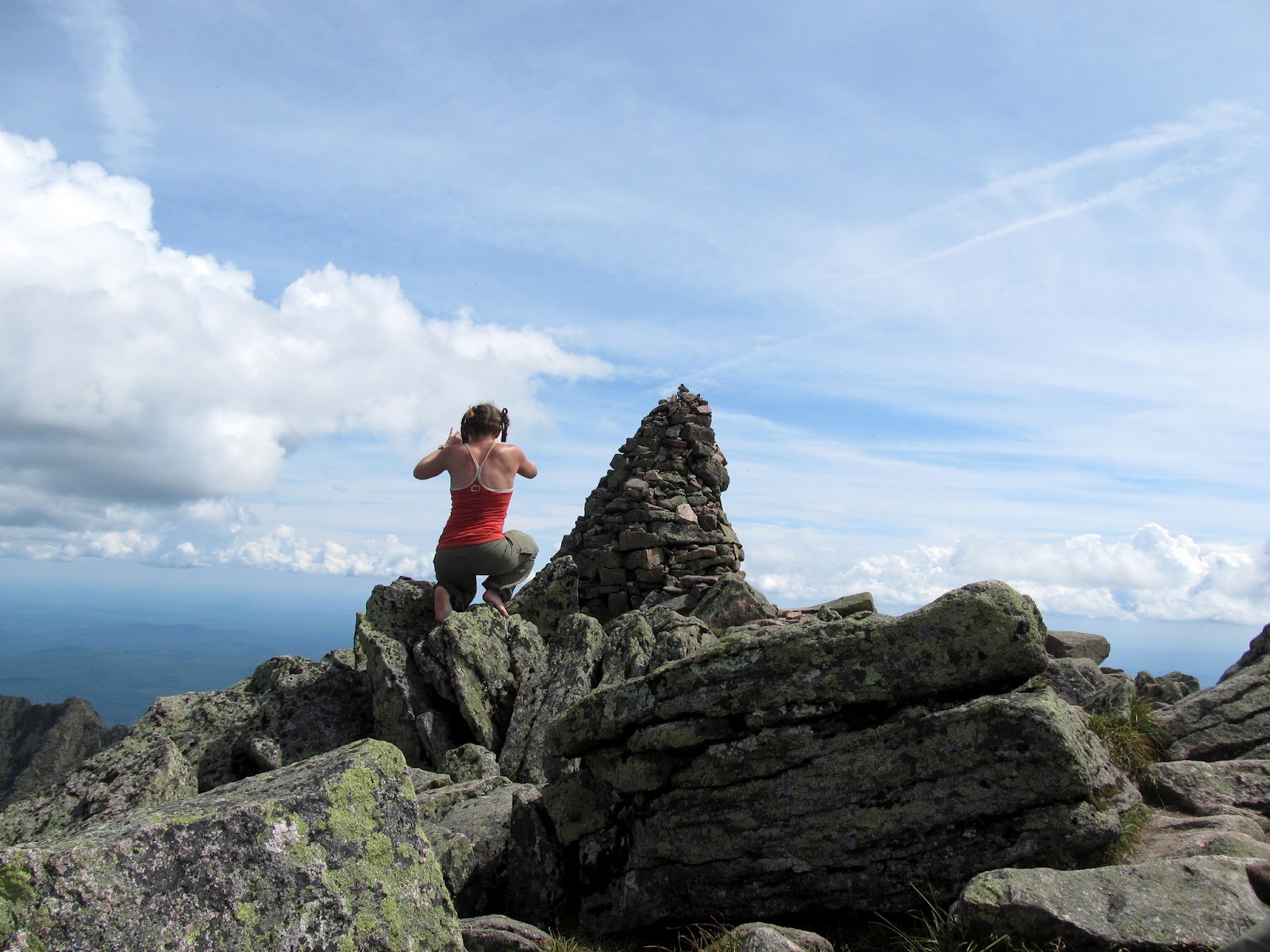
And then we were there. It had taken us 2-1/2 hours from the time we left Pamola Peak. I can only shake my head when I hear people talking about crossing the Knife Edge in an hour or less. All I can say is that in our case we enjoyed every minute and I'm not the least bit unhappy that we didn't make it faster.
When we got to the summit sign we found Lori, Melissa and Mike, part of our Baxter Bash crew, who had hiked up to Baxter Peak via the Abol trail and arrived just minutes before us. We hung out with them for quite a while, had our second lunch and enjoyed watching all the hikers tagging the summit. One was a through hiker with the trail name "Machine" that had finished the entire AT in 99 days. Do the math on that - just incredible! Another hike was sitting near us alone. Lori asked him if he was a through hiker and he responded rather quietly that he was. We asked him if he'd gotten in his "woohoo" moment at the sign. He said "I don't woohoo", but after some coaxing he let Lori take his summit picture and gave a victory yell that I think he really enjoyed. It was nice to be able to share that tiny part of his journey and his celebration.

Ready to join the summit celebrations!

We're here! Another checkmark on the bucket list

I think they took the easy way up
Melissa capturing the views

One of today's AT finishers. Woohoo!!!!

We reluctantly got up, said our goodbyes to the rest of the group (who were heading back down the Hunt trail) and headed down the Saddle. This is another beautiful stretch of trail with some great perspectives on the mountain, the Great Basin and the Tablelands. It's hard to image the contrast between the crazy terrain of the Knife Edge and the huge, flat expanse of the Tablelands when you first stand up there and see them together. What an amazing place.

Heading for the Saddle


Nat making her way down

Hamlin Peak across the Saddle


Hamlin Peak

Pamola peeking over the edge

Pamola and Chimney Peak. We climbed through that??

Back in the Saddle
We stopped at the bottom of the Saddle and briefly considered the option of heading the extra mile or so over to Hamlin Peak. It had been a long day though, and neither of us felt the need to get it this time. Next year will provide a new opportunity for that. We headed down the Saddle slide and into the Great Basin. The slide provided some interesting challenges of it's own with lots of steep, loose scree and dirt and a few sections of steep rocks and ledge to negotiate. It was really hot at that point too and with nowhere to hide from the afternoon sun we were happy to finally make it back into the trees at the bottom.

Starting down the Saddle slide


Heading for Chimney Pond
We stopped at the stream crossing after the slide and splashed our faces and filtered some water to replace our exhausted supply. We had brought 3 liters each and the hot day had caused us to use that up. It was great to feel the icy water at this point and get refreshed for the long walk out. We stopped at Chimney Pond and met one of the hikers that we'd met numerous times during the day on the trail who was nice enough to take our pictures.

Looking back on the day

Chimney Pond


The smiles say it all. What a day!
The rest of the walk back to the cars was unremarkable. On any other day the Chimney Pond trail would have been a very nice walk in and of itself, but we were tired, the adrenalin had worn off and it was just a 3.3 mile trek through the woods and along the streams and ponds that felt much longer. We both likened it to the 2-1/2 miles down the Tuckerman Ravine trail from HoJo's, but a mile longer.

Still 3.3 to go

Last look back
We signed out of the hiking register at 6:05pm - just over 12 hours after we started. We were both tired, achy, dirty, hungry and as happy as we've ever been at the end of a hike. I have to say thanks to a couple of friends (Dan and Dan) for helping me with the encouragement and advice to attack this hike and ultimately enjoy it so much. I also have to thank my friend Erich, who unknowingly gave me the piece of inspiration in the form of a quote on his Facebook page that I repeated for days leading up to the hike:
Security is mostly a superstition. It does not exist in nature, nor do the children of men as a whole experience it. Avoiding danger is not safer in the long run than outright exposure. Life is either a daring adventure, or nothing. - Helen Keller
Most of all, I want to thank my amazing wife for dragging my butt up there and making this one of the best days we've ever shared in the mountains. The best part of every one of these days is that we get to do it together.
I love you Honey. Happy very belated Birthday.