
This trip was planned many months ago (and thought about for much longer) by Kim. The plan was a Fourth of July long holiday weekend backpack across the whole Mahoosuc Range between Gorham and Grafton Notch. From the minute I heard about this hike I was some combination of intrigued, excited and intimidated. I knew that I was also "in", as was Nat. The list of potential participants fluctuated over several months but in the end wound up being Kim, Nat, Jen, Christine, Geneva (Christine's dog) and me. None of us had done any large part of the Mahoosucs before and all of us were really looking forward to it. From the time that Nat and I first ventured into this part of Maine last summer with Goose Eye and Carlo I knew that I wanted more. This is such a beautiful place! It's also a really tough place. Total trip - 31 miles with over 12,000' of elevation gain (and probably a lot more counting PUDs). Toss in Mahoosuc Notch - the so called "toughest mile of the AT" - in the middle just for fun. It also had the benefit of including Old Speck which is one of the NE67 4000 footer peaks that we needed as we wind down to the end of that list this year.
We had originally planned to go north to south - from Grafton Notch to Gorham - but a week or so before the hike we got a tip from a friend who's through hiked the AT saying that we really should reconsider. She said that the trail from Mahoosuc Arm down to Mahoosuc Notch was really steep and scary and that she'd never want to go down that way. That was enough for us - south to north it is! We met Jen in Grafton Notch on Wednesday evening and spotted a car at the northern trailhead (at the AT crossing). On the way back to Gorham we stopped at Sunday River Brewing for dinner and a pre-hike libation. They have some really great local brews there(for future reference). We then headed back to Gorham and spent the night at the Mt Madison Inn and Suites. I started to say the Mt Madison Motel, which is what it's always been known as, but they've done a total makeover recently and it's really nice (and the rates are still good). Christine and Geneva opted to meet us in the morning and avoid an even more crowded room - there'd be enough crowded sleeping space the next few nights on the trail.
We met Christine and Geneva for breakfast in the morning at the White Mountain Cafe. The first signals of the problems ahead had already begun for me. My stomach had been a bit "off" the day before and this morning I really didn't want to look at food. Not really a good thing when facing an 11 mile, 4500' hike on a 85+ degree day. I had an oatmeal and a juice and tried to make the best of it. Everyone else chowed down on the strawberry-rhubarb pie from the Puzzle Mountain Bakery "pie lady" and it just about killed me that I couldn't manage to even try a bite of one of my favorite foods. Rats!
The southern terminus of the Mahoosuc Trail is next to the Gorham Hydro Station - probably no more than a quarter mile from our motel room - but across the river. The drive to the trailhead is 10 miles though - down Rt 2 to the North Rd bridge in Shelburne and then back 4 miles up Hogan Rd to the trailhead. Hogan Rd is dirt and was not in particularly good shape. There were lots of serious ruts and potholes and some very large, deep puddles and mud from the recent rains. We had two AWD vehicles and were glad we did. This could actually have been avoided if we'd gone up the Centennial Trail (part of the AT) which starts at the junction of North Rd and Hogan Rd and is only a couple of extra tenths. Would have been a good idea. The description of the parking area for the trailhead in the AMC WMG is also not very specific. They indicate that you shouldn't park at the Hydro Station, but it's really the only place there is. We assumed that they meant directly in front of the station, as there was room for probably 5-6 cars across the road, which is where we parked. Our cars were there when we got back (thankfully) so it was apparently OK. After all this time, preparation and crazy logistics - it's finally time to hike!
Day 1 - Gorham to Gentian Pond
o 

Getting ready at the southern end of the Mahoosuc Trailhead

Outside the parking area by the Gorham Hydro Station

Androscoggin River Reservoir

Power Anal???

We're at the trailhead. Where is the sign pointing?

Getting organized
The trail is a climb from the beginning. Over the course of the entire route there are very few flat areas, pretty much everything is ups and downs. The recent rain had also had a serious impact - not for water crossings, but for mud. I've never seen this much and during the first day I heard it compared to "Adirondacks mud", which is apparently not a term of endearment. The first section is a bit more than 2.5 miles of pretty unmemorable trail up to Mt Hayes.

Steps up to the Mahoosuc Trail

What passes for a trail out here

Part of the Power Anal perhaps?
Mt Hayes is one of the peaks on 52 With A View and although the views were hazy that morning it was pretty obvious why. On a nice, cool fall day with a hike up the Centennial Trail this would be a really nice little peak! Today it was kind of hot and buggy and we got attacked by swarms of ants that were everywhere on the ledges on the summit. Very strange.

Views beginning from the ledges of Mt Hayes

Christine and Geneva

Hey look, a puddle!

Christine
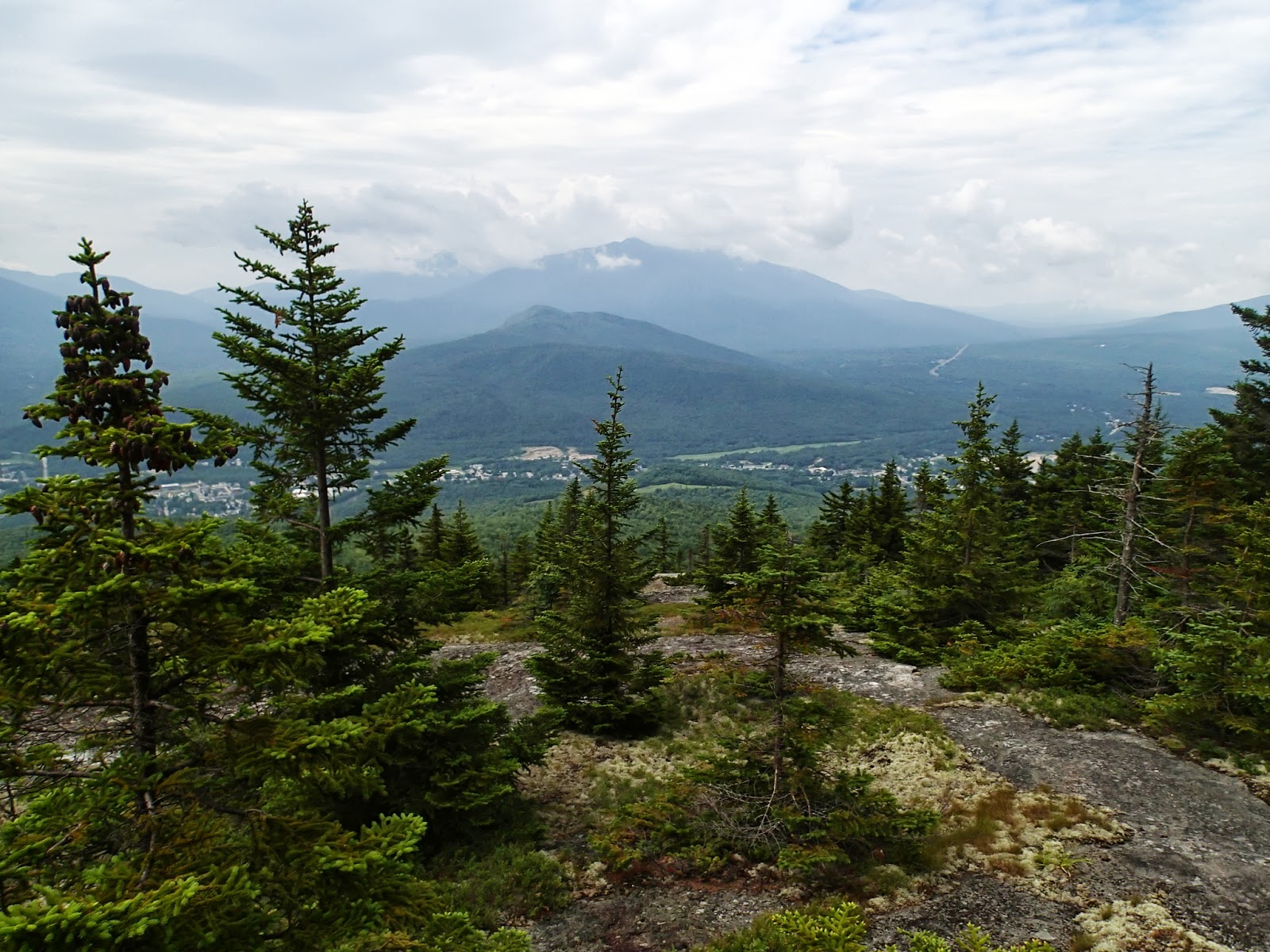
Hazy views approaching the top of Mt Hayes

Geneva and I on Mt Hayes

Hmmmmm. Checking out the ants perhaps?
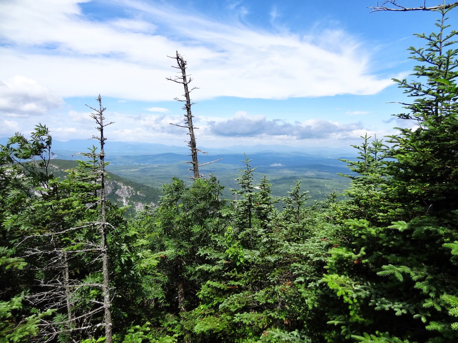
After Mt Hayes the trail drops into a col and heads back up to the top of Cascade Mtn. There are some pretty spots in the col, some nice brooks for wading (if you're Geneva) and more views from the top of Cascade. On any other day I would have enjoyed the walks up the ledges, but the heat and lack of fuel were already beginning to get to me - and we were less than half way there.

Ooohhh - a brook!

Spring Beauty


On my way to the top of Cascade

Views from Cascade

More Cascade views.

I seem to be in heads down mode

Geneva

Jen and Geneva

Geneva waiting for Nat and Christine.

Wicked deep mud.

Walking in the col

More views

Somewhere near Trident Col

Nat and Jen
Shortly after Trident Col we arrived at Page Pond. This is really a pretty spot. Definitely not a place for a swim (unless you're Geneva) but a bit of cool feeling on a really hot day. We had a bit of trouble finding the trail around the pond - it's not all that obvious. Then again, it's not really all that much of a trail

Page Pond


Surveying Page Pond - looking for the trail

Hey, a POND!


Ahhhhhh.

Yup, this is the trail

Me following the old bog bridges on Page Pond...no losing the sunglasses trying to find the trail this time.

Not as bad as it looks
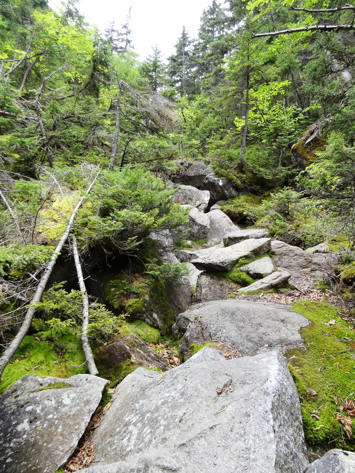
Past Page Pond came the worst section of mud yet. Geneva had to get lifted out by the handle on her pack and when Kim stuck her trekking pole in it to check the depth she got nearly to the handle without hitting bottom! Yikes! Past the quicksand-mud-bog-thing we were treated to yet another wonderful scramble up the slabby, rooty, slippery trail up Wocket Ledge. It wasn't really all that bad, but I was really ready to be done at this point and we still had over 3 miles to go. On, up and over...

Takin' a break

Ick... Quick - grab the handle before she sinks!

When it wasn't muddy it was like this today

Nat making her way up to Wocket Ledge

The trail up Wocket Ledge


I think I've had it by this point
The last few miles we really didn't take many pictures. We got surprised by a thunderstorm (which really didn't materialize), trekked over many more small PUDs, did our best to avoid the continual mud and dodged the incredible series of blowdowns that are still left from last year's storms. We made our way by Dream Lake (dreaming that it was actually Gentian Pond) and finally to Gentian Pond itself and our home for the night.

Mr. Frog is very confused..he thinks he heard thunder

But there's blue sky over there

Nat, Jen and Geneva...heading toward Dream Lake. It started to thunder and lightening about here

Still lots of damage from last year's storms

Upper Gentian Pond - almost there!
We arrived at Gentian Pond to find the shelter quite full (we weren't planning on using it anyway) and several available tent platforms. It was already late and by the time we got the tents set up, water filtered and dinner cooked it was getting dark. There wasn't a single picture taken that night in camp - we were all too focused on other things - so I can't show how it looked. This really is a nice spot though, and would be worth returning to. After dinner nobody had enough energy left for anything and we all just turned in for the night.
I had already started to question whether I could hold out for three more days like this one. We've done plenty of prior hikes with equal or greater "stats", but none that were close to this hard for me. The combination of those stats along with the heat and not being able to eat enough had just done me in. My initial thoughts were that I should try to make it through the second day and hope for better results. The problem was that there were really no good bailout options at that point (at least not without having to call someone for a pickup out on Success Pond Rd). I figured I'd sleep on it and decide in the morning.
Shortly after getting into bed I got cramps in both legs. I've had this problem before, but never in both legs at the same time and never quite like these. I'm sure that dehydration and the other conditions of the day were a major factor. I'd drunk about 5 liters of water over the course of the day but I still probably wasn't enough. At that point I made up my mind - I really wanted to do the rest of the hike, but not like this.
When we woke up in the morning I told Nat that I had decided to bail. She felt really bad and said she'd go out with me, but I really wanted her to continue on (as long as she was up to it). She reluctantly agreed to keep going without me. We got up and started breakfast and a few minutes later Christine came over and told everyone that she and Geneva had also decided to bail. Christine badly broke her ankle last winter and although she had a great recovery and had been back to hiking, this trip was really being hard on it. The night before when we got to camp we had discovered that the doggie backpack that Geneva was wearing had gotten wet and had soaked the Primaloft blankets that she was carrying to sleep on and was really heavy. None of us knew this until we took the pack off. She was really tired from the extra weight and unlike her always-ready-to-go self she was not looking happy.
So it was settled. We shuffled the shared gear around so that Nat, Kim and Jen had the right stuff for the three of them to continue. Nat still had over 70% battery left in her phone and we figured that if she left it off and just turned it on to check in on summits and at campsites it could last the rest of the trip. It was really hard for me to leave, but I knew that it was the right choice and I was glad that the other three had agreed to continue. We said our goodbyes and headed out.
The Day 2 Walk Out
Our hike out was down the Austin Brook Trail (3.5 miles) and then a 7.5 mile road walk on North Rd and Hogan Rd back to the cars. Another 10.5 mile hike on another hot day isn't the easiest bailing option, but it was much easier than what the other three had for their day ahead - another almost ll mile and 4500' gain day to Full Goose shelter. I didn't take a single picture on the way out and I'm really sorry now. The Austin Brook Trail is a really pretty route. After a relatively gentle climb down from Gentian Pond the trail wanders around beaver ponds, through wildflower meadows, along logging roads, across several brooks and finally along the edge of a very pretty brook all the way out to the road. One caution, there are several spots that aren't well marked and we did a bit of excess wandering. At one point we were following boundary marker blazes rather than the trail (which we discovered pretty quickly) and then made a couple of wrong turns (or missed turns) near the crossings at the bottom. Having the GPS helped and ultimately we were never too far off. We were back at North Rd at 10:30 and stashed our packs in the woods behind the parking area and took just some food and water for the walk to the car. Almost the entire road walk was shaded, which we were very thankful for. The 3 miles of North Rd passed quickly. We figured that this was about the half way point, but Hogan Rd is actually 4.5 miles more from here. We kept seeing landmarks that we thought were "the last hill before the parking area" or "the dam at the Hydro Station", but in each case were wrong. We finally got back to the cars at 2:00 which all in all wasn't so bad. We were really tired and sore, but agreed that it was much better that we would have felt going across another set of mountains. Happily Geneva seemed to be almost back to her old self as well. We drove back and picked up our packs and then headed to Mr Pizza in Gorham for some much needed libations and food. Christine and Geneva headed back home and I went and got a motel room for the next two nights.
I spent the next two days wandering around the Mt Washington valley enjoying the scenery and wishing I was with Nat, Kim and Jen. I still knew that I'd done the right thing. Nat continued to check in multiple times a day to let me know they were OK and even was able to post pictures each day. The battery in her phone miraculously lasted until after they were done on Sunday and I was really thankful to hear from her and know that they were OK. So enough about my journey - this was about a Mahoosuc Traverse and that's what the others did. I've only been able to experience it through their stories and Kim's pictures and that's the way the rest of it will be told here. The interspersed text is mine, the captions on the pictures are Kim's
Day 2 - Gentian Pond to Full Goose
The views that we all awoke to at the start of this day were pretty sweet.

View from Gentian Pond Shelter

This was the way out for Christine, Geneva and Mark

Gentian Pond
This was the day that I had most looked forward to in the trip. When we stood on Goose Eye last summer and looked at the Mahoosuc Trail running both north and south over the beautiful alpine terrain I wanted to do more of it. The section between Goose Eye and Carlo had been wonderful and the part to the north looked even better. Mt Success looked pretty nice too. Another day.
The day started with the hike up Success from Gentian Pond. Since Nat and Kim had done this last fall on "girls weekend" they already knew what to expect (or should have). I thought I remembered them saying that this was a tougher climb than the maps would indicate, but when I talked to them about it at the start of the trip they didn't remember it being too bad. Apparently my memory was better than theirs. It's 3.5 miles to the summit with quite a lot of elevation gain. Just getting to the top was the goal - no visit to the plane crash today.

Very overgrown trail on one of the many pud's to Success.
Spectacular clouds

Nat on the trail up to Success

It was much colder when we were here in November

We see the summit ahead

Our first Zeke sighting

Nat and I on Success

Jen on Success
From Success it's about another 2 miles to Mt Carlo. Shortly before the summit is the Carlo Col trail and the campsite we would have stayed at on our second night had we gone north to south. Looks like an interesting section.

Nat maneuvering up the rock

Looking back at Success

Trail junction - .2 to go to Carlo Col trail

Nat on the way to Carlo Col

The first ladder of the trip

The NH/ME state line

Nat heading to Carlo

Views near the summit of Carlo

Nat making the tight squeeze on Carlo

This cave was calling my name...I didn't answer this time though

Nearing the Carlo summit. Goose Eye peeking over the top

Jen and Mr. Toucan on Carlo

Me on Carlo

Nat and I on Carlo
I remember the section between Carlo and Goose Eye very well. A very nice 1.5 miles indeed! The scrambling and climb up the rungs and ladders must have been fun - I even enjoyed it last time. Not so sure about that tricky section of ledge between the ladder and the rungs with a full pack though...

Nat and Jen on the bog bridges of Carlo

Nat with Goose Eye in the background

Nat approaching Goose Eye

There's Jen...waiting for us again

Nat climbing the first of many ledges on Goose Eye

Jen taking the direct route

We'll soon be climbing that ladder

Jen and Nat...

Iron rungs...these are an added challenge with a full pack. Still lots of fun though.

Nat and Jen...starting the rungs

Mr. Toucan learns to climb

Hold on Mr. Toucan

Nat making her way across the tricky section to the ladder
(Yup, this is the section I meant [Mark])

Nat climbing the ladder

Mr. Frog...doesn't understand why I made him climb the ladder

Jen at the bottom of the ladder

We'll be heading over that subpeak of Goose Eye (East Peak) and across the plateau

Close up of the firetower on Old Speck. That's two days away

The route we'll be travelling the next couple days

Jen, me and Nat on Goose Eye
Nat had check in with me from Goose Eye and it was already getting late in the day. Earlier they had considered a shorter day but decided to push on to Full Goose. It would certainly seem to be worthwhile to get a short day the next day for Mahoosuc Notch and Arm. That last 2.6 miles to Full Goose had to have seemed to go on forever. There were storms that looked like they might be moving in as well (but fortunately never materialized). There was some rain, but that's all.

Wine Jug...who carries one of those this deep into the woods???

Views of Goose Eye

Nat approaching Goose Eye North Peak

We'll be going to the other side of the big PUD before we reach Full Goose Campsite

Jen and Nat making their way down the subpeak

Very interesting trailwork

These were on an angle so the tread helped

Stairs too

Beautiful ladders

Great views on this section of trail

Very dramatic clouds

Something is rolling in...it looks like it's raining

Goose Eye and North Peak

Nat...prior to the rain

We had to get a shot of these iron rungs. Both of us commented on how much Mark would have hated this section

Nat downclimbing the iron rungs with a full pack in the rain. Fun!!

Looking up at the iron rungs
When they got in to Full Goose it was already late and basically time to set up camp, eat and go to sleep again. Too bad not to get more time to enjoy the evenings. Such are the joys of very long days on the trail.

A slug made it's way onto Nat's bag

Jen's setup with Christine's tent

Full Goose Campsite - We had a very steep hill outside the front door. Behind us was blowdown

Looking at the tent from the back

This was my sock, insole and gaiter drier

The privy and the continuation of the Mahoosuc Trail

Full Goose shelter
Nat texted me again in the morning. They were once again suffering the results of the long hot days and were now exchanging times with stomach woes. They wound up staying at camp late to rest and recover and didn't leave until 10:30. Today was the day they came for though - Mahoosuc Notch. It was also the one that had me most nervous. After seeing their pictures I think I'd be happy to go back and try it, but preferably with a day pack. First up, the 1.5 miles across Fulling Mill Mtn and down to the notch.

Nat heading up Fulling Mill Mtn

The trail on Fulling Mill Mtn

Looks like it could rain again

Views in every direction

Nat and Jen making their way down the slippery ladder
And now the fun begins...

Jen - at the Mahoosuc Notch sign. The playground we had waited for


Nat nearing the notch

Ice chunks...natural air conditioning

The start of the notch

Nat and Jen

Up, down, over and under

Jen scoping out the route

What does that X mean???

Nat working her way through the notch

Jen and Nat on an easy section of the notch
I wonder what that down arrow means...hopefully a cave :)

Nat figuring out the puzzle that is the notch.

Every move takes thought

Ooohhh...a cave

Nat squeezing though the hole

Jen and her full pack squeezing through the hole

stuck...on the sleeping bag

Mist over the ice

You can see the steam coming up from the ice holes
(Is this a Johnny Dangerously reference [Mark])

Jen scoping out the route

Another tricky section

Nat and Jen in the notch

Nat climbing over the rock

Nat in one of the caves

Nat coming out of the cave (an apparently having fun!)

Jen climbing down into a hole

Jen in a misty hole
(Better than a fargin' ice hole [Mark])

Nat in a another cave

Nat downclimbing a steep section

This way...

Nat opting for a different route...Jen waiting on the other side

Jen coaching Nat

Jen...about to cross the root

Careful where you step

Jen on the root...also the route

Views from the cave

Nat at the cave entrance

Nat and I in the cave

Nat and I in the cave

Jen in the last tricky section of the notch

Nat climbing out of the last tricky section

Jen

Nat

Hands and knees for this part.
After finally getting through the Notch (which had taken almost 2-1/2 hours) they took a long break and dealt with some minor logistic issues. After that long ordeal what's your reward? Why a climb up the very steep ledges of Mahoosuc Arm of course! This was the section of trail that we'd been warned about that had caused us to reverse our route. Based on the pictures and what Nat and Kim told me about the trail, MEB was definitely right. I don't think I'd have enjoyed this much even going up and certainly wouldn't have wanted to go down. Kim said that it wasn't really that bad since you could "tree hug" all the way up. What a great endorsement! The very few pictures taken in this stretch tell me that concentration was definitely elsewhere...

Climbing the pile of boulders on Mahoosuc Arm

The start of Mahoosuc Arm

Mahoosuc Arm

Nat leaving Mahoosuc Arm
From the top of Mahoosuc Arm to Speck pond is a pretty flat and then down 1 mile. There are no pictures from here - I suspect that the only thing on anyone's mind was getting to camp. They got in late again and once again didn't have much chance to enjoy the evening. Looks like Speck Pond would be a really nice spot to hang out. Perhaps a future trip...

Speck Pond...we didn't get much time to enjoy it since we had to set up camp, filter water, cook and clean up

Tent platform #5 at Speck Pond
Day 4 - Speck Pond to Grafton Notch
It was another late morning start for the final day. It was just a 5 mile hike over to Old Speck and then down to the notch, but it had clearly been three pretty grueling days already and nothing is really easy at this point. Nat texted me again from the campsite and told me when they figured they'd be back down. I had the day to kill and drove down through Pinkham Notch and had lunch in North Conway before heading back up to pick them up. In the meantime, they headed out for Old Speck.

Nat and Jen looking at our next destination

Success Pond in the background

Nat and Jen making their way up Old Speck
 Looking back across the Mahoosuc Trail
Nat at the spur trail to Old Speck. It's a fairly flat .3 miles

Summit of Old Speck. This was my 4th time and also the 4th season.
Since the day that Nat and I began our hiking journey of the 4000 footers almost six years ago there hasn't been a single peak that we haven't stood on for the first time together. She never turned back, even after splitting her head open a mile before the summit on Carrigain on our NH48 finish. This was probably the hardest part of bailing on this hike for me - I knew that I wouldn't be there with her on this peak. It really doesn't matter - for the record. We'll go back and do it again together (which I have to if we're going to finish the NE67 together). It was just symbolic for me somehow. I even had a choice here - I could have hiked back up on Saturday night and met them at Speck Pond or on Sunday morning and just done it as a day hike to meet them on Old Speck. But I didn't - and I'm sorry
 Nat on Old Speck #61/67.
(Sorry Honey, I should have been in this one with you)
 Nat climbing the firetower
  Baldpates in the distance
(Hopefully Nat and I will be hiking those this weekend)
 Nat, me and Jen with Mr. Monkey, Mr. Toucan and Mr. Frog on Old Speck
  Nat and I on Old Speck
 Nobody told me anything about the hike down (except that they had decided to skip the Eyebrow - which Kim has always wanted to do). No worries, we'll go back this fall and get the Eyebrow (on the way up though) and I'll get my day on Old Speck. I do know that it took a long time getting down. No surprise after the 25+ miles that preceded it. I waited for them at the Sunday River Brewery, but nobody was interested in stopping - the only thing on everyone's mind was getting home, taking a long hot shower and sleeping for many hours in something that didn't have to be set up on a wooden platform.
 Heading down the ledges on Old Speck
 Nat at the Old Speck trailhead after completing the 4 day Mahoosuc backpack
 The three survivors!
 Nat and I at the finish line
One day...I will do the Eyebrow
I learned many lessons over these few days. There are things that I did that I know were the right decision and that I'll always remember. There are also regrets. What I know most of all is how glad I am that Nat, Kim and Jen decided to go on and finish what we all started and how proud I am of Nat. This woman shows me every day how incredibly strong she is and how able she is to do anything she puts her mind to. I'm so incredibly lucky to have her to share my life with. Love you Honey!
Here's the interactive route: http://www.gpsies.com/map.do?fileId=qrxpgyykdvafoohv
Note that this is not GPS recorded but traced on the trails on the USGS map. The distance shown is also inexplicably off by 7 miles (24 vs. 31 actual)

Complete Route

Day 1 Part 1

Day 1 Part 2

Day 2 Part 1

Day 2 Part 2

Day 3

Day 4

What an amazing backpack - tough but rewarding. Big congrats to the those who finished. Having to bail is always a hard decision, especially when you feel like you have no control over what your body is doing. BTDT, not fun. I think you did the right thing, and in the end you had some company on the way out, rather than doing it solo. Don't have regrets, life it too short. You've got an amazing wife and great relationship, enjoy that!
ReplyDeleteSummerset www.nh48.wordpress.com
Thanks Summerset. You're right of course, life is way to short for regrets. Hoping that 5 days up north this weekend will be the perfect antidote for any left over negative vibes. :)
DeleteMark
Wow! What a trip - your photos are amazing. Goose Eye looks particularly interesting. Thanks for detailing the trip, some great inspiration!
ReplyDeleteTom
www.tomhikesthewhites.blogspot.com
Thanks Tom. Wish I'd done the whole thing with the girls - the last three days were the best (but maybe also the toughest). Goose Eye is awesome! If you didn't already see it, here's the post from our first trip to Goose Eye and Carlo last summer. This was just a wonderful day hike and the views on a clear day are pretty much unmatched. A loop over Goose Eye and across all of the Goose Eye subpeaks and out at the south end of Mahoosuc Notch would be perfect. Just need a car spot on Success Pond Rd.
Deletehttp://theramblingsblog.blogspot.com/2012/07/venturing-into-maine-goose-eye-and-carlo.html
Mark
Thank you for posting this, I must say this has got to be one of the most comprehensive trip reports of the mahoosuc traverse I've come across and the pictures were wonderful. I also have not yet seen such thorough pics of the mahoosuc notch, only the usual ones that people post, this gives me a better perspective of its length and challenge. The overall photos really gives a person a clear understanding of what they are undertaking if they are going to do this hike. I've always read it is a rough traverse, but the pictures give a good perspective of what to expect. I've had this on my "bucket list" for a while and had planned on doing in in 09, but weather did not permit the week I had planned and life has sort of got in my way since then. I had thought of doing "day" trips to get it done in sections, but that would require a great deal of driving. I realize now that I may like that option better, since it looks very challenging not just physically, but mentally. WOW. A big congrats to the ladies accomplishment (and having the courage to climb that Old Speck Ladder!!!) I am always amazed at AT'ers who zoom through that section as well as people who do it in a day??!!!
ReplyDeleteGlad to hear the dog made it out safely without drowning in mud, that is some picture!
Thanks again for taking the time to write and post these pictures, that took time and effort and is a great chronicle of the hike. I plan to "bookmark" this so when/if the day comes, I can be reminded of what I am getting myself into!!! Kudos to everyone!! Good stuff!
Hiking Lady
Thanks! I wish I'd been able to stick it out with the ladies. I'll definitely be back to do at least parts of it. I hope you get to check this one off your bucket list - it's definitely an amazing hike!
DeleteMark
Thanks so much for the trip report. I'm planning the Notch day hike next weekend. This gave me my first visuals. Greatly appreciated.
ReplyDeleteCP