
We had hoped to do it Tuesday, but after the increasingly hot weather and violent thunderstorms on Monday night we were looking at the weather as a key factor. The forecast for Tuesday was hot and muggy (mid 80s) again with a significant chance of thunderstorms. On the other hand, Wednesday was supposed to be high of 71 and sunny - absolutely perfect. Problem was, Wednesday was when we were going home. We checked with the campground and the site was available for an extra night. This was just too good an opportunity to pass up. We're staying!
After four straight days of hiking we weren't too disappointed to have a down day to rest our legs before the long Isolation trek. We decided that a drive through Grafton Notch, a nice lunch out and a little exploring would be perfect. Tuesday was hot and muggy as predicted, but the storms held off during the day and we had a nice low key adventure. We drove up Rt 16 to Lake Umbagog and then Rt 26 down through Grafton Notch. We stopped in Bethel for lunch and then looped back across Rt 2 to Gorham. This was a really nice drive with some interesting stops along the way. The first was LL Cote (LL who?) in Errol. Quite the place! In Grafton Notch we stopped at the main roadside attractions - Moose Cave, Mother Walker Falls and Screw Auger Falls. From there is was a stop at the pie stand for the biggest whoopie pie I've ever seen (we somehow had the resolve to pass on the strawberry rhubarb pies) and then on to Bethel. Here's a couple of shots along the way. The whole album is here if you're interested: ALBUM

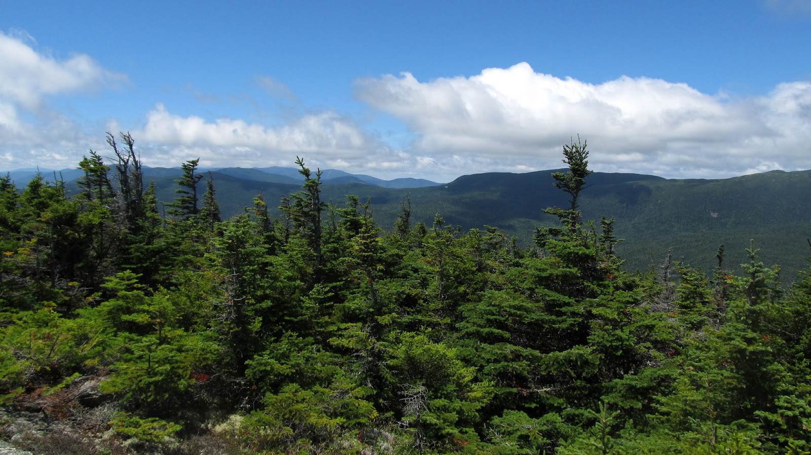
Pontook Reservoir

Pontook Reservoir over Northern Meadowsweet

LL who?

Found this family hanging out by the road

Nat checks out the Moose Cave

No moose in here...

Upper Screw Auger Falls

Lower Screw Auger Falls

This thing must weigh 2 pounds!
On to Isolation...
On Tuesday night we got another round of thunderstorms. I was now starting to think about what the water crossings on the Isolation Trail might be like now. We'd heard plenty of stories about these crossings (including the one in Trish's "UP", which was really scary). There were equally horrific stories about the Rocky Branch and Isolation trails with their propensity for flooding and ankle deep mud. I sent a message to Ryan at the Mt Washington Observatory and asked for his opinion. He said that the summit had gotten almost 3 inches of rain in the last two nights, but there hadn't been any flood warnings and that we really should be fine. Thanks for the advice Ryan - it's nice to have friends in high places ;-) This made me feel much better, but the thoughts of a long, wet slog and difficult crossings still were in my mind.
The other thing that I wasn't sure of was my willingness to do the Rocky Branch route in general. Seems everyone hates this trail. Originally I had figured that we'd go up and back Glen Boulder which would both avoid the water crossings and eliminate the dreaded Rocky Branch and Isolation trails. I really wasn't sure my knees were up to a long, steep downhill at the end of a 12+ mile day and decided that the Rocky Branch route was the better option. We kept our fingers crossed...
We got an early start with a stop at McDonald's in Gorham for coffee and oatmeal (both of which are surprisingly good there). On the way down Rt 16 before the auto road we were treated to a bear foraging in the field by the side of the road.


We stopped for a few minutes and then headed to the trailhead. We made a quick stop at Pinkham on the way and got the first real view of what the day was going to be like. Gorgeous! All the humidity was gone and the air felt like a mid-September day (and the skies were that brilliant fall shade of blue).

We got to the trailhead and were the only car in the parking lot. By 7:30 we were geared up and on our way. I was prepared for the Rocky Branch Trail to be awful. It had to be steep, rocky, eroded, muddy and who knows what else. Over the first two miles the footing was good, the grades were easy and it was just a nice walk in the woods on a beautiful morning. I was worried - something really bad had to be coming.

Here we go... the dreaded Rocky Branch

Now THAT'S a blowdown!

Turtlehead


New England Aster

At about the 2 mile mark the trail gets flat and follows the contours on Engine Hill. This was more nice walking through grasses, ferns and wildflowers in a really pretty section of woods. There were many wet sections of trail, but they were all lined with stepping stones that were very easy walking.

Rocky Branch

Beautiful morning

Easy rock hop walking

Great hydration! A Pina Colada for the trail
We kept waiting for the terrible section of Rocky Branch to appear, but it never did. We were now at the first big crossing at the junction with the Isolation Trail. What horrors awaited us now?!

First big crossing

Heading for Davis Path
The water level was fine and we were easily able to rock hop the crossing. Now we were on the Isolation trail. There must be bad things ahead. At minimum, we know there are four more crossings. The beginning section follows the brook and is really a beautiful walk. So far, so good.

Beautiful walk along the brook

Cairn on the other bank at the next crossing

OK, where to from here?

Got it


Hanging cairn?
We followed the brook and made the other crossings without any more problem than the first one. This is just a lovely stretch of trail (at least on a day like this).


Beautiful trail!

How are you going to hate this?

Next crossing (3 more to go)


#3

After the crossings we entered what was probably the most beautiful section of the day. I believe I saw this described as "fairy woods" in someone else's report. I can see why. Mosses, ferns, streams and everything that a woodland sprite would need to be happy.

Entering the "enchanted forest"

So green!

Ghost flowers?

Near the top of the Isolation Trail there are a number of official off-trail tent sites. The WMG still describes this as a difficult to follow section of the trail due to all the branches, but most of the tent sites have signs on the main trail and we had no trouble navigating at all.

One of the official tent sites. We're going to have to stay here someday!
Shortly after the tent sites we hit the junction of Davis Path. I was confused. Where had all the terrible sections of Rocky Branch and Isolation trails been? At least a half dozen times along the way Nat and I had commented to each other what a beautiful walk this was. We both agreed that even if there hadn't been a summit with a view at the end that this would have been one of the nicest hikes ever. But oh, were there ever views waiting...

Final stretch

And the views begin!

Looks like we're here!
The walk across Davis Path went quickly and we enjoyed the emerging views in a couple of fir waves along the way. When we got to the Isolation spur junction we found a man who we had been leapfrogging back and forth with on the last half of the trail standing there with a map, scratching his head. Based on the sign (lower on the tree) he figured we had gone too far. I was puzzled too since the GPS seemed to indicate we were in the right place. Nat finally was the one to look up and see the sign. It's fairly high up on the tree and none of us had seen it. Duh. We headed up the short scramble to the summit and were greeted with our ultimate reward. The views up here are just incredible!

Cloud cap on the southern Presis and Mt Washington

Final steps to the summit

Eisenhower peeks out
We pulled on our extra layers, as it was really windy and pretty chilly up here (a real contrast from the last couple of days). We hung out with the guy we'd been hiking with for a while and found out that this was his 37th 4000 footer (and he was planning Owl's Head next). We never got his name, but wish him the best of luck in his finish.

Nat and I on Isolation (almost) for #43


Clearing over Boott Spur
After a quick break we went up to tag the real summit and make it official. This was definitely one of the nicest hikes ever!

Now it's official!

On the summit


Wildcats


Baldfaces in the distance

We hung out and ate our lunch. I was in no hurry to go anywhere and was hoping that we were going to get a view of Mt Washington if that cloud cap would just move. It never did. Oh well, guess we'll have to come back for that view another day.

Mt Washington refuses to emerge

Nat bundled up for lunch
We finally gave in and decided to head down. After the wonderful walk up we were really looking forward to the return trip. We weren't disappointed. We thoroughly enjoyed the first five miles. The last two, as our legs started to feel tired, we basically put it on cruise control and got to the bottom. The pictures can tell the story from here...

Time to head down :(


Last look...


Fir wave


Back into the enchanted forest


Indian pipes

Still happy to be here

Back across

Orange hawkweed

Time for a reward

Mmmmm


Final stretch


Last photo. All downhill after this...
We were back at the car at 5:30 - just about 10 hours total. There was nothing that the trip down had done to change our opinions of this day. Among a long string of really wonderful hikes over the years, this was absolutely one of the best! This will definitely be one that we'll do again (and certainly at least once in winter). We ended the day in Gorham, sitting on the deck overlooking the river at Mr Pizza and refueling on large portions of delicious pasta. We knew that the week was over and that we'd be going home tomorrow, but we couldn't have ended it on a better note. A bit of Isolation is most certainly not a bad thing!
That night I got out the Kindle and read the Isolation chapter in "UP" again. It sounded as horrific as I'd remembered. Hard to believe that this was the same hike. The only part that I regret is that we didn't meet the grouse...
If for some reason you haven't read "UP" yet, GET IT! http://amzn.to/Mkyqdw
The map and some Google Earth aerials...

Trail Map

From the south

From the east

From the north

From the northwest
I guess the secret to Rocky Branch Trail is to hike it a) in winter or b) after a period of drought. I am very glad the two of you had a nice hike. You were spared the typical Rocky Branch experience...you might not be so lucky if you attempt it a second time, lol.
ReplyDeleteThanks for the plug. :)
I was actually surprised that the 3" of rain the previous days didn't have more effect. When I re-read your chapter I could picture all of the spots and imagine what they would be like with ankle (or calf in Alex's case) high water. Torture.
ReplyDeleteYou're very welcome for the plug. I do it every chance I get. It's really one of my favorite books of those that I've read in the last few years - it's easy to recommend.
Was great seeing that you guys got to Monadnock this week. Looks like you had a perfect day. Wish we could have joined you. We'd still love to join you for some more of your 52WAV hikes (or anything else). Love those peaks! We've only done 11 so far, so lots to go.
Mark
Hi Mark,
ReplyDeleteWe'd love to hike with you again -- maybe we should plan a day and have an A peak (for good weather) and a B peak (for bad)? Will pm you tomorrow afternoon, hopefully we can figure something out for the near future.
Trish
Good for you Mark. Geez, my last memory of that trail is that last three miles being like hiking through a Brazilian rain forest. After a time I just gave up and trudged through two feet of water and mud. I think I started getting trench foot by the time that hike was over!
ReplyDeleteSeems like your memory is what most people that have done Rocky Branch (other than in winter) have. It would certainly be a long, miserable hike in those conditions. I guess timing really is everything.
DeleteMark
Great pictures! I just did Isolation as well and there was no grouse to be seen... sigh.
ReplyDeleteThanks Allison. I was bummed about not meeting the grouse, but after my one prior grouse encounter perhaps it's just as well. Several years ago we were walking up the road to the hiker parking across from Highland Center and one flew out of the bushes and directly into the side of my head. At the time I figured that it was accidental, but perhaps he was a cousin of the Isolation grouse and actually just had good aim. ;)
DeleteMark
Great report, Mark. Given how low the waters have been in most streams, it seems that mid-to-late summer, a drier time of year, is the recipe for a good Isolation hike not requiring traction. Beautiful photos again!
ReplyDeleteI've met one grouse so far, in May on my second trip to my namesake mountain in Vermont, descending toward the Pond from the firetower on the A.T. About halfway down the mountain, maybe a bit more, I'm traipsing along the gentle slope at a good clip, daydreaming and soaking in the bounty of green, when all of a sudden there is this loud avian explosion about 10 feet in front of me, mid-trail. Quite startling, shocking even. Daydream definitely deferred!
As soon as I gathered my wits, I recognized that it was, indeed, a dreaded mother grouse, and she didn't go far, rather hovered nearby, glowering at me. I didn't loiter long, but did scan the area enough to ID what looked like her nest a half-dozen feet or so left of the trail. Needless to say, I departed her roosting area with dispatch, caught my breath and carried on.
If you get a chance to do the Stratton/Pond loop from Stratton-Arlington Road, Mark, I highly recommend it. On a clear day you get extraordinary views to the Whites, the Adirondacks, Central and Western Massachusetts from the firetower, and the alpine forest crowning the long ridge is sumptuous. The pond is a lovely treat along the way, too - just know that it can be very buggy down in the flats near the pond on a day, as I found out in May, where there are few issues up on the mountain. Last time I forgot bug spray, and my shins still bear the marks from it.
But I ramble, which I guess is the point here. :)
Thanks again for another fine report. Very pleased y'all 1) had a good trip, and 2) showed me the way to have a similarly good visit to the Isolation tank.
-Chris Stratton/Arkie
Nothing wrong with rambling Chris, rambling is good. ;)
DeleteSounds like quite the interesting grouse encounter. Lots of stories from folks out there. The look like such innocuous little birds. Who knew they could be so fearsome.
Your namesake loop looks like quite the beautiful hike. Definitely one that will be on our list in the future.
Mark
This comment has been removed by the author.
DeleteMost days in season, the Green Mountain Club stations summit-keepers at a small hut near the summit tower. Jean and Hugh Jhourdi, a married couple, will be there, either one or both. Jean kindly looked after me on my first Stratton hike, asking after this chubby newbie to make sure I knew what I was doing sufficiently on a cold-trending mid-October day in 2010 - I was hiking the family namesake near my birthday. Very nice woman, and I appreciated her caring. I passed muster and made it back to my car, safe and sound, right as it turned dark, bailout option declined - was ready but not needed.
DeleteHugh and Jean both were there in May and were entertaining three hikers who'd arrived ahead of me. They had a big apple pie they were sharing - I happily partook of a big slice. Sat and chatted with them for the better part of 45 minutes. Hugh, as with me, is an amateur geologist and knew tons about various New England mountains, allowing my mind to go into sponge mode. I was able to share some useful nuggets as well. Could have stayed and visited with them all day.
Incidentally, their cabin was recently attacked by a bear trying, it would appear, to get into some tasty food inside. Neither of the Jhourdi's was in at the time, though a member of Whiteblaze was there at the summit tower and witnessed the attack. There are a couple of threads on it at Whiteblaze at these links: http://www.whiteblaze.net/forum/showthread.php?86835-Stratton-Mountain-Bear-Sighting&highlight=bear+stratton and http://www.whiteblaze.net/forum/showthread.php?86831-Bear-activity-on-Stratton-Mtn-VT&highlight=bear+stratton
-Chris
Congrats on another fine hike (and peak for THE LIST)! Some great shots - the bear "encounter" is very cool.
ReplyDeleteThanks Owen. The list is getting short. Won't be long till we'll need a new one ;)
DeleteMark
Great report!
ReplyDeleteEven after completing the NH 48 and NE 4000 many years ago with numerous others thrown in the mix, Isolation still stands as an all time favorite.
Liked it so much I went back for a second. 1st hike was up Rocky Branch and then over Isolation-Davis Path, 2nd time all the way via Davis Path with a stop at Mt. Davis south peak (this view is incredible and similar to the Isolation panorama). Here-here for the fairy woods!!
I've seen the pie stand you enjoyed but have not stopped. Being a fan of whoopie pies I'll have to stop in soon. Next time you are in Grafton Notch you'll have to check out the less-known-unsigned and most impressive "Jail". A friend tipped me off with an old description and we eventually found the yellow blaze on the guardrail and faint path leading into a hidden gorge. We wondered why the name? But after performing the required squeezing down through the hole in the ledge to the bottom of the gorge, we realized there was only one way out.
From "Hidden Treasures of Nature in The Northland" by Richard E. Pinette:
"A little known natural formation shaped like a jail cell. You can enter through a small opening and lower youself into the jail..." "Drive to Screw Auger Falls..."(park)...(walk)"Follow a roadside guardrail uphill away from the falls a few hundred yards above the falls. Near the upper end of that guardrail, look for an inconspicuous trail which leads down the bank and into the woods. At the foot of the bank, look to the left near the ground and you will see the opening (window) of The Jail."
Andrew
Thanks for the tips Andrew! When we met our trail companion at the Isolation spur junction he was thinking that we were at Mt Davis. Now I kind of wish we had been. I know we'll be back up there again though. The Jail sounds most interesting! We were apparently very close. We'll certainly be visiting Grafton Notch in the future - a the very least to hike Old Speck and the Baldpates. Will definitely have to check this out. Love to find these "little known diversions".
DeleteMark
Perfect hike! I'll have to try Isolation this way some day. You had such a gorgeous day, it was wise to stay and extra day and take advantage of it. Congrats!
ReplyDeleteThanks Summerset. I think we both had pretty good "days in Isolation". Everyone I know that has done Rocky Branch is still shaking their heads at our experience. Timing is everything. The extra day was indeed the best! Gotta grab those when we can.
DeleteMark
Mark - just getting around to doing some reading. This is an awesome trip report. Your photos are just perfect. This looks as if it is one of the more beautiful depictions of Isolation I've seen. It looks like a new Isolation sign there. I also like Snickers on the trail - a definite boost of energy. I look forward to seeing a similar day on Isolation sometime.
ReplyDelete